
Advanced geospatial technology that connects the physical earth and digital world
Trimble® is an industrial technology company, concentrated on helping the world work, better. Trimble technology enables jobs to get done more precisely and accurately so you can build, construct, grow and move the things we need to live our lives and build future communities.
Transform the work of surveying, mapping, 3D modeling and more through geospatial technologies and progressive industry tools in precision technology.
-
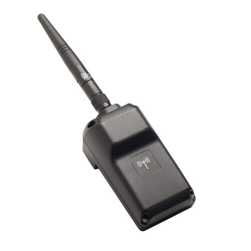 Trimble EMPOWER robotic radio module to connect with total stations. ONLY AVAILABLE FOR DELIVERY IN MO, IA, IL, IN, KY, MI, NE, and WI
 -
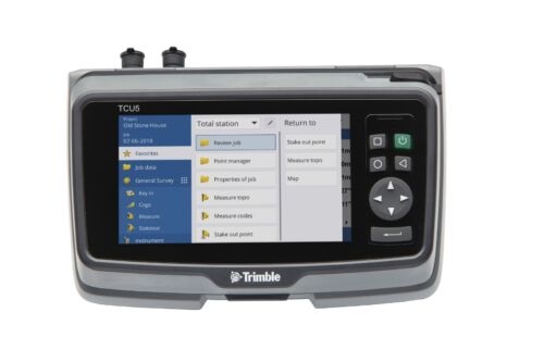
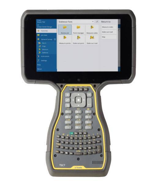
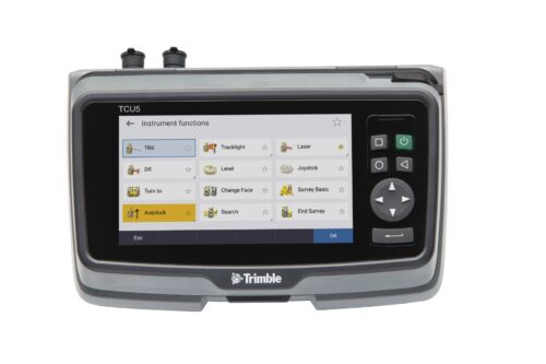 TCU5 Model 2 rugged field controller elevates your productivity
 -
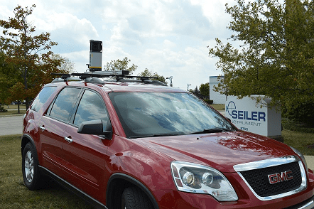
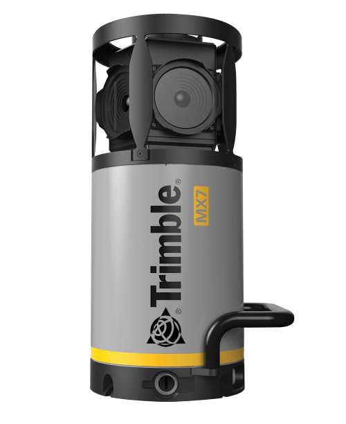 Contact us for details and special pricing! This demonstration unit has full warranty on hardware! The Trimble MX7 is a vehicle-mounted photogrammetric system equipped with six, 5 megapixel cameras, and Trimble Applanix GNSS and inertial geo-referencing modules. The Trimble MX7 can be deployed on vehicles of all sizes, letting you capture 30 MP geo-referenced images at highway speeds.
 -
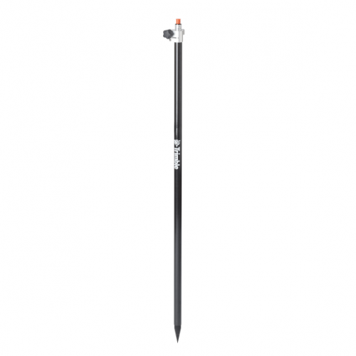
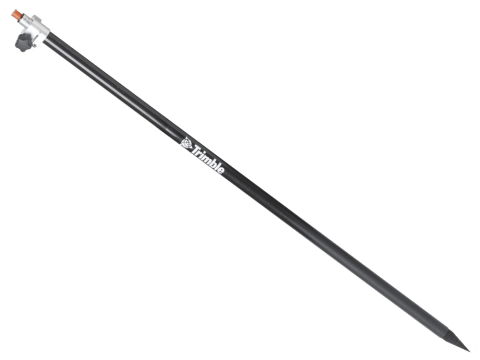 Markings offset by Trimble Standard target height (135mm) Carbon fiber and aluminum telescopic range pole - 2.6 meter. Accessory - Layout Rod - 2.6m Telescopic Rod
 -
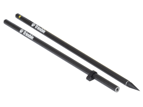 Accessory - Layout Rod - 2m Fixed Height Carbon Fiber Rod. Fixed height two part, 2 meter, carbon fiber range pole. P/N: 43169-10
 -
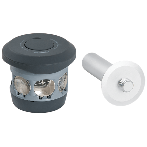 The 360 prism designed for Integrated Surveying with the Trimble R10 GNSS receiver. Compatible with all optical instruments. Request a quote - contact us. Accessory - RTS/RPT - 360 Prism includes height adapter to Trimble Standard target height (135mm).
 -
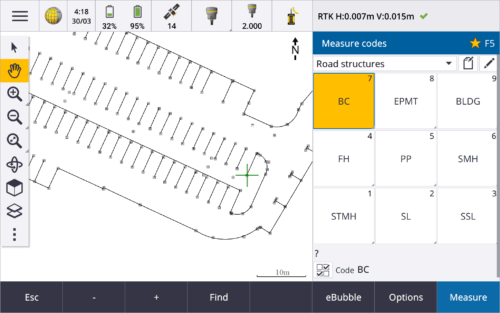
 Trimble Access™ software suite offers surveyors and geospatial professionals a range of specialized field applications designed to make fieldwork easier.
 -
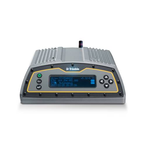 The Trimble Alloy™ reference receiver is ready to take on the requirements of any real-time network, in any environment, anywhere in the World. With tough IP68 housing, and modernized satellite tracking Trimble Alloy receiver can also be used as a campaign receiver for post-processing, as a Continuously Operating Reference Station (CORS) receiver or portable base station for Real-time Kinematic (RTK) applications – and even as a scientific reference station.
 -
 Trimble Business Center is Office Software for Surveyors. Contact us for a demonstration and/or quote. Complete your field to finish workflows and expand business opportunities with unique deliverables:
- Topographic base map creation for construction and land development
- Cadastral/ALTA drawings for boundary mapping
- Workflow automation through using templates and feature coding
- Perform Cut/Fill Map analysis, Corridor Design, Inspections and Volume Computations
-
 Rod - 2.5m Carbon Fiber Telescopic Range Pole without Bipod
 -

 The Trimble DA2 GNSS receiver is the next generation receiver for the Trimble® Catalyst™ GNSS positioning service. The DA2's performance scales with your Trimble Catalyst service subscription to deliver anywhere from centimeter to sub-meter precision to location-enabled Android™ and iOS field apps & workflows. Order or learn more here about Catalyst.
 -
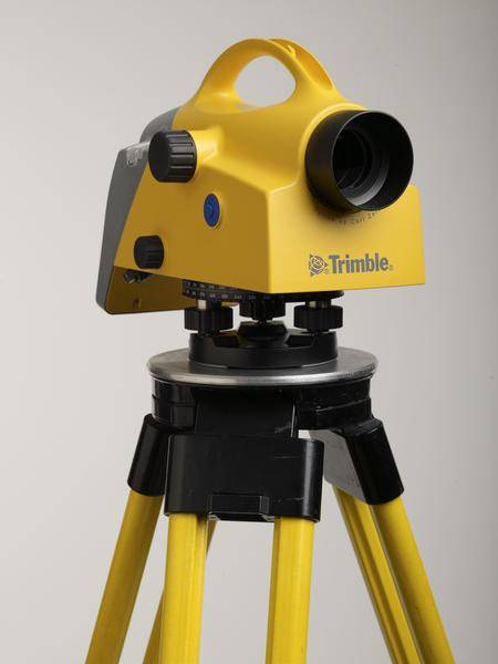 Trimble DiNi Level Digital Height measurement sensor - Trimble Quality and Accuracy for Measuring with Confidence. Contact us to buy or learn more.
- Determine accurate height information 60% faster than with automatic leveling
- Eliminate errors and reduce rework with digital readings
- Transfer data to the office easily
- Level Accuracy 0.3 or 0.7 mm