

The Trimble® TDC6 data collector is a powerful, versatile and cost-effective field data collection solution for surveying and mapping professionals. Use the TDC6 standalone as a GIS data collector, paired with a GNSS receiver or as an onboard total station controller.
-
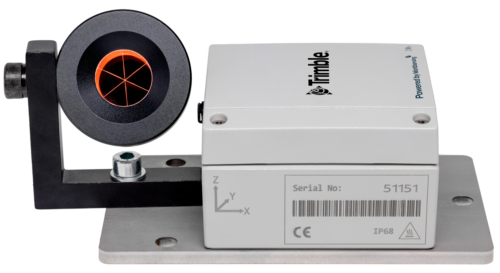
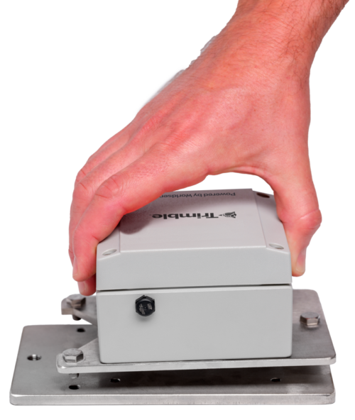 Wireless Tiltmeter Monitoring sensor with internal antenna. Precise Movement Detection.
 -
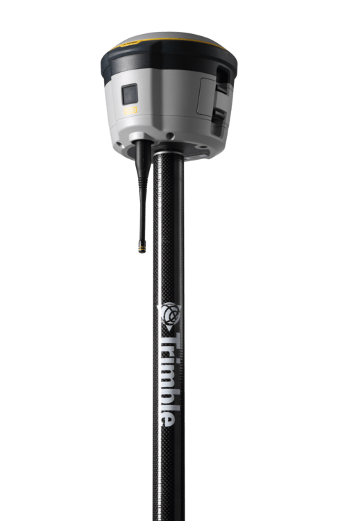
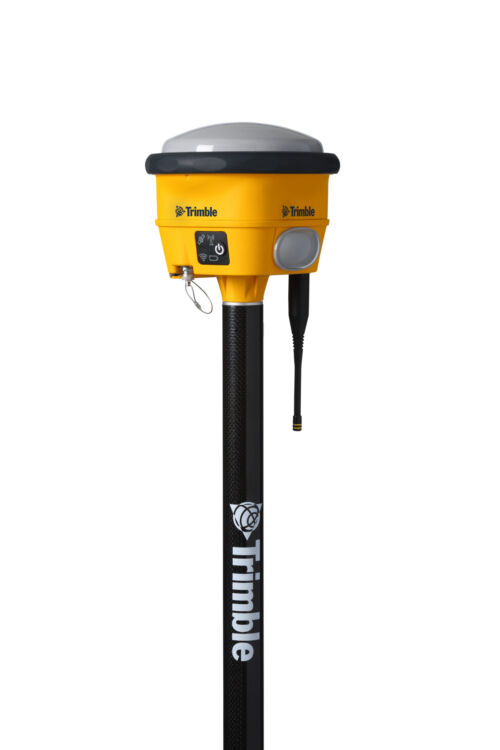 The Trimble® R780 GNSS receiver allows you to choose your configuration and scale up by adding additional features. With robust GNSS positioning technologies, trust this ultra-durable receiver to boost your productivity and flexibility in any environment.
 -
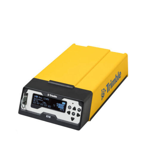
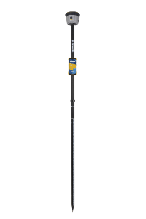
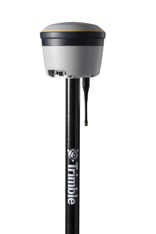
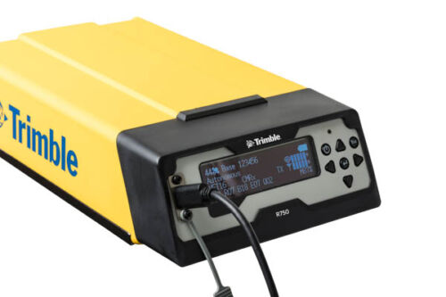 Get reliable coverage no matter where you work with the Trimble® R750 modular GNSS receiver. Work efficiently and accurately, even in tough conditions, while receiving all the information you need, right at your fingertips.
 -
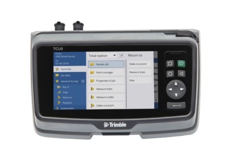
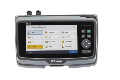 TCU5 Model 2 rugged field controller elevates your productivity
 -
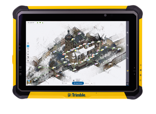
Push the limits of productivity. Tackle large scanning datasets and workflows confidently with the Trimble® T10x tablet.
-
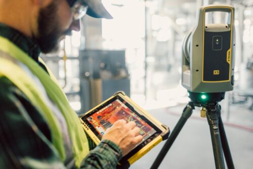
 Trimble Perspective field software is specifically designed for in-field scanner control and complete registration when working with a Trimble 3D laser scanning system like Trimble X9 or X12.
 -
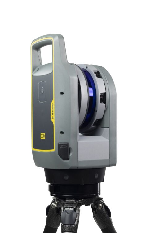 A 3D laser scanning system built with proven Trimble technologies, offering the range, accuracy, scan times and sensitivity you need to do more, better, and faster.
 -
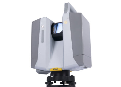
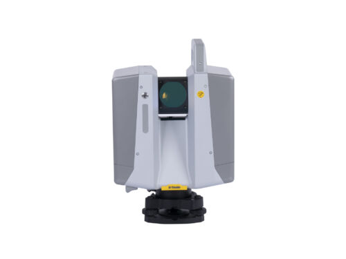 The Trimble X12 is a 3D laser scanner with the speed, accuracy, range and HDR imaging to capture the highest quality data available to produce impressive deliverables for demanding projects.
 -
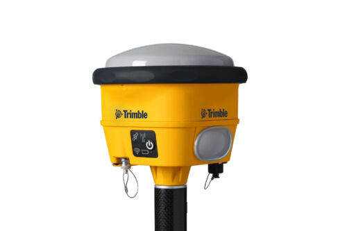
 Proven reliable positioning
Depend on the Trimble® R580 GNSS system to keep you working with survey precision. Powered by the industry-leading Trimble ProPoint® GNSS engine, this everyday integrated receiver delivers greater productivity and reliable accuracy in more places.
Benefits and performance
With increased accuracy and reliability in difficult urban and rural environments, the Trimble R580 optimizes productivity using powerful GNSS technologies for maximum results.Productivity maximized
The Trimble R580 harnesses Trimble ProPoint technology so you can survey with precision in difficult places, boosting field work productivity like never before.Trimble dependability
With proven technology to guard against anti-spoofing and multipath issues, the dependable R580 provides confidence for every measurement and point you capture. -
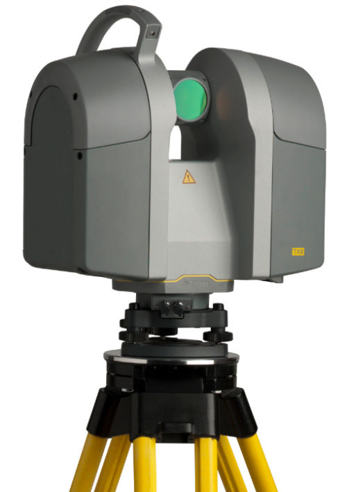 The Trimble® TX8 laser scanner sets new standards for performance and ease of use in high-speed collection of 3D data. Using a state-of-the-art blend of speed, long range and precision, the Trimble TX8 delivers high quality results in civil survey, industrial measurement, engineering and construction. It’s the scanner of choice for high levels of productivity, accuracy and flexibility. Contact your local Survey Sales Specialist to find out more.The Trimble TX8 is designed for a broad array of uses and environments. Typical applications include: ► Civil engineering ► Surveying ► Plant and industrial measurement ► Mining and quarries ► Urban areas ► Preservation and restoration ► Building and commercial construction ► Deformation monitoring ► Quality control ► Public safety and forensicsDetailed Data Sheet
 -
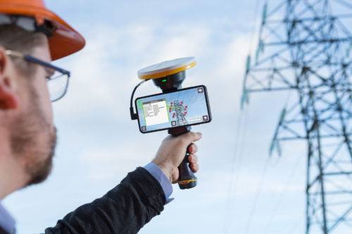
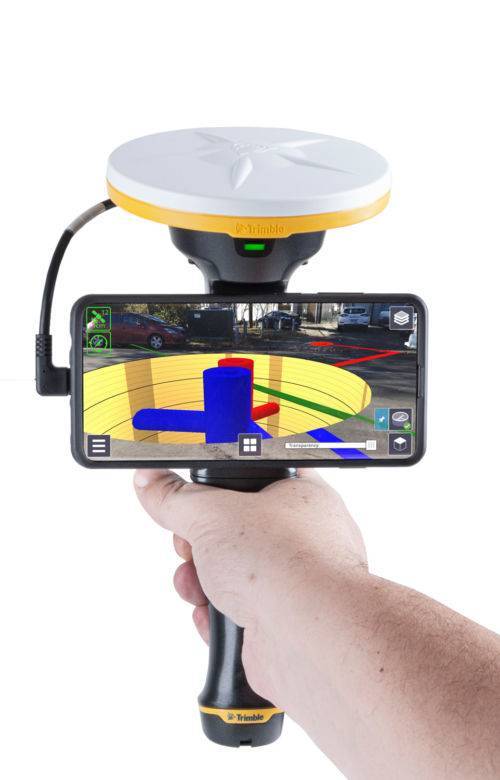 Trimble SiteVision is a user-friendly outdoor augmented reality system that brings data to life so you can visualize and explore complex information with unrivaled accuracy. Learn More Here.