-
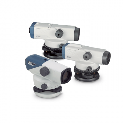 The Sokkia Auto Levels Model B20, B30A and B40A are durable, dependable, high value auto levels.
 -
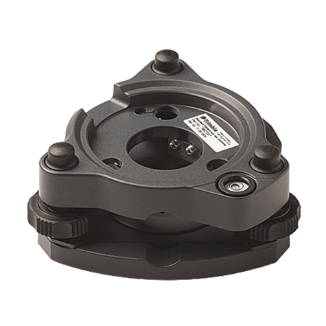 Replacement Tribrach for Trimble S Series instruments or Trimble Traverse Prism kit. Also compatible with Trimble SX10 instrument.
 -
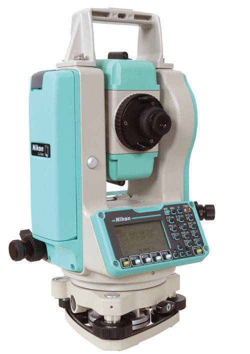 Sale Price listed while supplies last!- CURRENTLY OUT OF STOCK The Nikon NPL-322+ Series of mechanical total stations includes a 5" single face model. Nikon total stations are economical, versatile, easy to use, and feature Nikon's legendary optics. Product includes:
- Angle accuracy: 5" (1.5mgon) (ISO 17123-3)
- EDM type: Reflectorless technology
- Distance accuracy: 2 mm + 2 ppm Distance range: Up to 3,000m (9,840 ft) to single prism (ISO 17123-4)
- Reflectorless range: Up to 400 m (1312 ft) (KGC 90%)
- Compensator: Dual axis
- Compact, lightweight total station
- Graphic LCD display, Single face
- Full numeric keyboard, Single face
- Internal memory of 25,000 records
- Internal Bluetooth, laser pointer
- 1x NPL-322+ main unit
- 2x Li-Ion Long-life Batteries
- 1x Clip-on Battery Holder
- 1x Tribrach
- 1x Plastic Carrying Case
- 1x Universal Charger, Power Cord and Adapters
- Total weight on bundle above is 23 lbs. Box dimensions 21 ½” x 13 ¾” x 15”
-
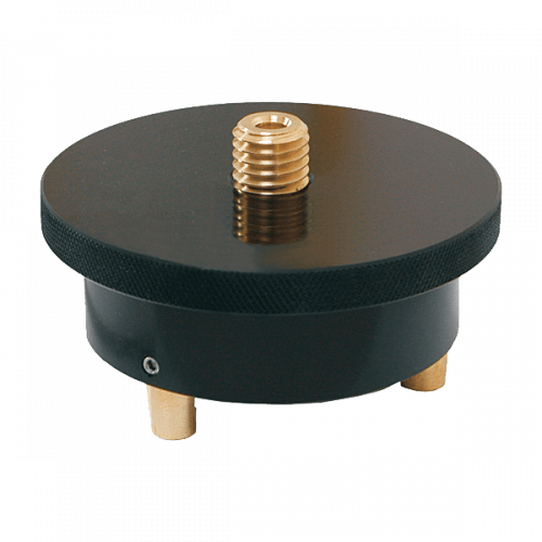 This rotating friction top tribrach adapter allows the prism to be pointed after installation in the tribrach Fits all tribrachs Weighs 0.9 lb (0.41 kg)
 -

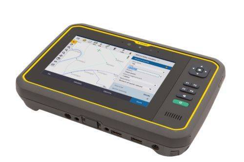
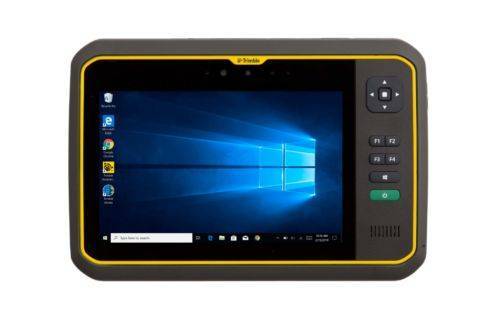
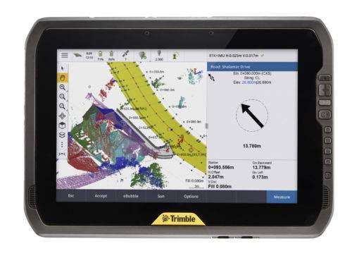 You can depend on It. The T100 is Trimble’s latest high performance tablet. With a sleek, rugged design and 10-inch touchscreen you can read in any conditions, the T100 handles anything the work day dishes out. See full datasheet here. The T100 at a glance...
- Large 10.1-inch touchscreen.
- Full Windows desktop applications.
- Integrated long life battery.
- Ergonomic design.
- Expandable Trimble EMPOWER modules.
- Enjoy the convenience of an all day battery—for a full days work, every day.
-
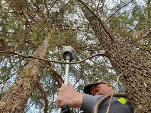
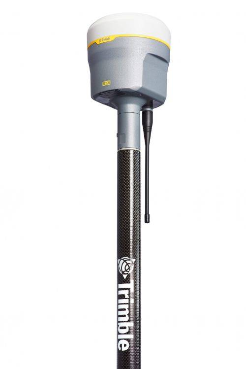
 Precise, powerful, game-changing technology in an ergonomic design for easier and more comfortable handling. All-new Trimble ProPoint GNSS engine allows surveyors to push the boundaries of GNSS performance, with at least 30 percent† improved performance in challenging GNSS environments*. How? Flexible signal management enables the use of all available GNSS constellations and signals, resulting in higher satellite availability.
 -
 Trimble Business Center is Office Software for Surveyors. Contact us for a demonstration and/or quote. Complete your field to finish workflows and expand business opportunities with unique deliverables:
- Topographic base map creation for construction and land development
- Cadastral/ALTA drawings for boundary mapping
- Workflow automation through using templates and feature coding
- Perform Cut/Fill Map analysis, Corridor Design, Inspections and Volume Computations
-
 This adapts retro prisms to Swiss-style tribrachs Includes a removable Zeiss plug and locking screw Fits all tribrachs Weighs 1.75 lb (0.80 kg)
 -
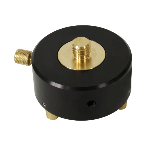
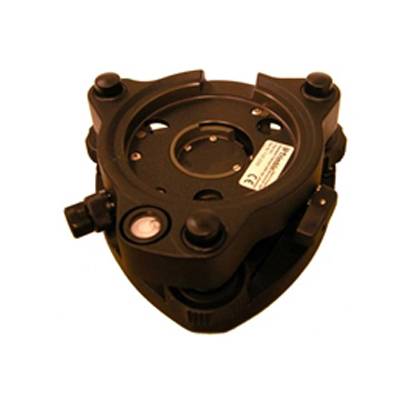 Accessory - RTS - Tribrach with Optical Plummet
 -
The Trimble® TDC6 data collector is a powerful, versatile and cost-effective field data collection solution for surveying and mapping professionals. Use the TDC6 standalone as a GIS data collector, paired with a GNSS receiver or as an onboard total station controller.
-
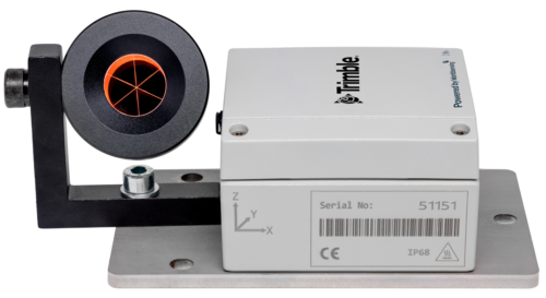
 Wireless Tiltmeter Monitoring sensor with internal antenna. Precise Movement Detection.
 -
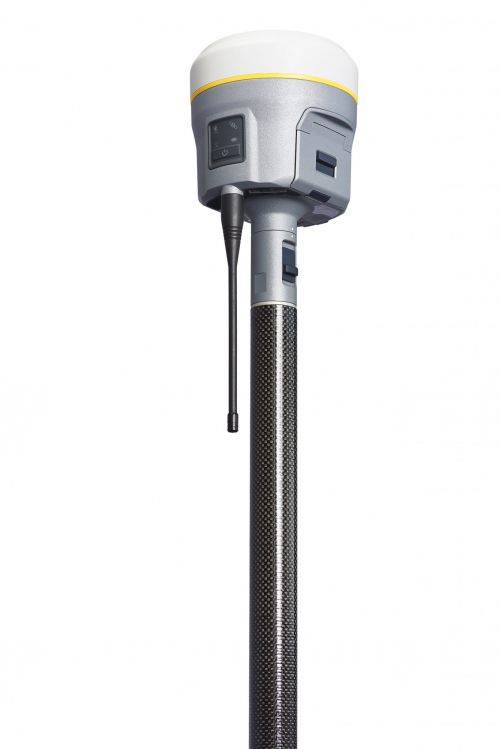
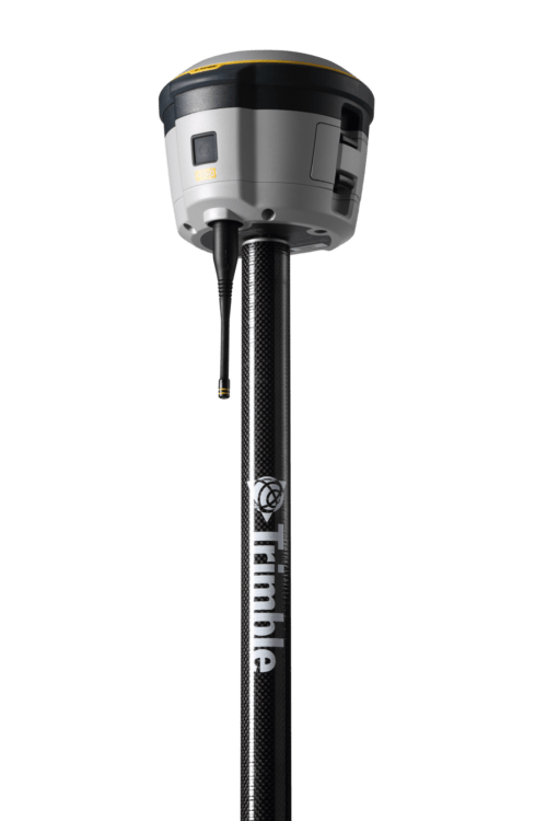
 The Trimble® R780 GNSS receiver allows you to choose your configuration and scale up by adding additional features. With robust GNSS positioning technologies, trust this ultra-durable receiver to boost your productivity and flexibility in any environment.
 -
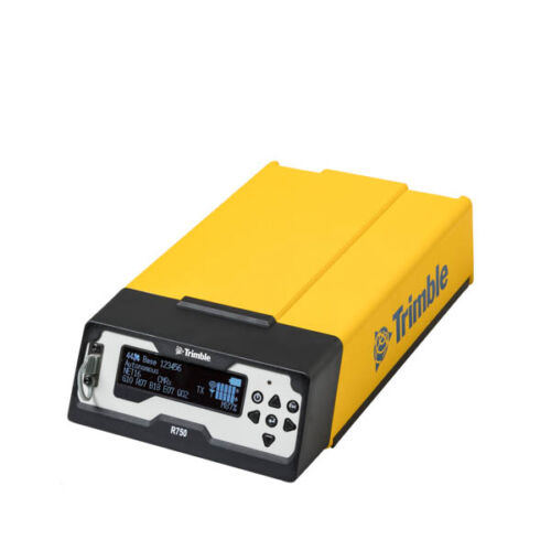
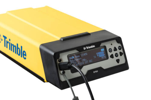 Get reliable coverage no matter where you work with the Trimble® R750 modular GNSS receiver. Work efficiently and accurately, even in tough conditions, while receiving all the information you need, right at your fingertips.
 -
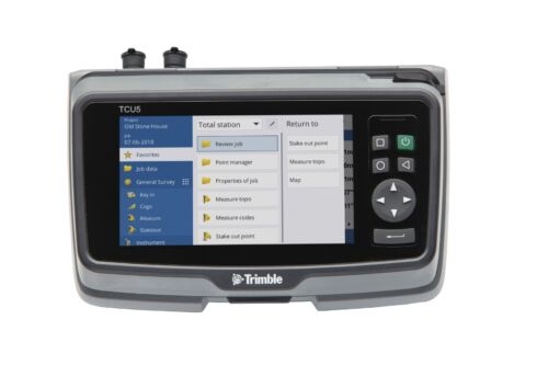
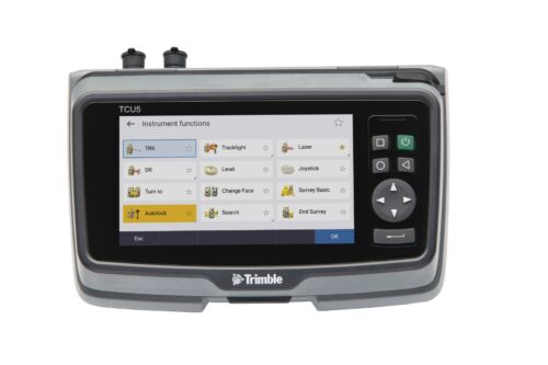 TCU5 Model 2 rugged field controller elevates your productivity
 -
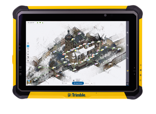
Push the limits of productivity. Tackle large scanning datasets and workflows confidently with the Trimble® T10x tablet.
-
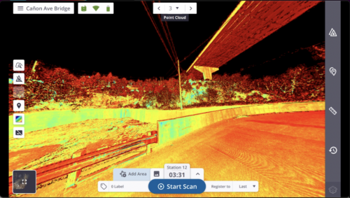
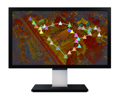 Trimble Perspective field software is specifically designed for in-field scanner control and complete registration when working with a Trimble 3D laser scanning system like Trimble X9 or X12.
 -
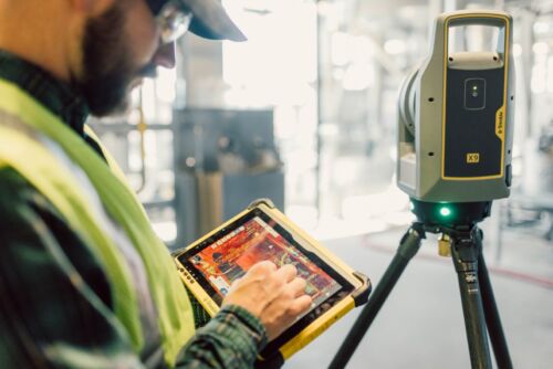
 A 3D laser scanning system built with proven Trimble technologies, offering the range, accuracy, scan times and sensitivity you need to do more, better, and faster.
 -
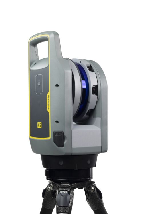
 The Trimble X12 is a 3D laser scanner with the speed, accuracy, range and HDR imaging to capture the highest quality data available to produce impressive deliverables for demanding projects.
 -
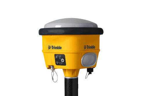
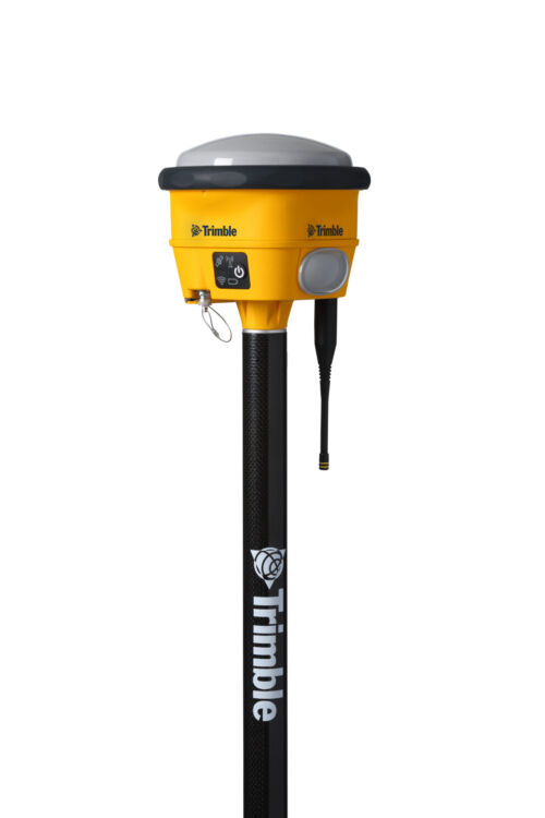
 Proven reliable positioning
Depend on the Trimble® R580 GNSS system to keep you working with survey precision. Powered by the industry-leading Trimble ProPoint® GNSS engine, this everyday integrated receiver delivers greater productivity and reliable accuracy in more places.
Benefits and performance
With increased accuracy and reliability in difficult urban and rural environments, the Trimble R580 optimizes productivity using powerful GNSS technologies for maximum results.Productivity maximized
The Trimble R580 harnesses Trimble ProPoint technology so you can survey with precision in difficult places, boosting field work productivity like never before.Trimble dependability
With proven technology to guard against anti-spoofing and multipath issues, the dependable R580 provides confidence for every measurement and point you capture. -
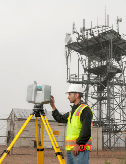
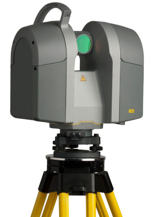 The Trimble® TX8 laser scanner sets new standards for performance and ease of use in high-speed collection of 3D data. Using a state-of-the-art blend of speed, long range and precision, the Trimble TX8 delivers high quality results in civil survey, industrial measurement, engineering and construction. It’s the scanner of choice for high levels of productivity, accuracy and flexibility. Contact your local Survey Sales Specialist to find out more.The Trimble TX8 is designed for a broad array of uses and environments. Typical applications include: ► Civil engineering ► Surveying ► Plant and industrial measurement ► Mining and quarries ► Urban areas ► Preservation and restoration ► Building and commercial construction ► Deformation monitoring ► Quality control ► Public safety and forensicsDetailed Data Sheet
 -
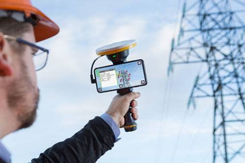
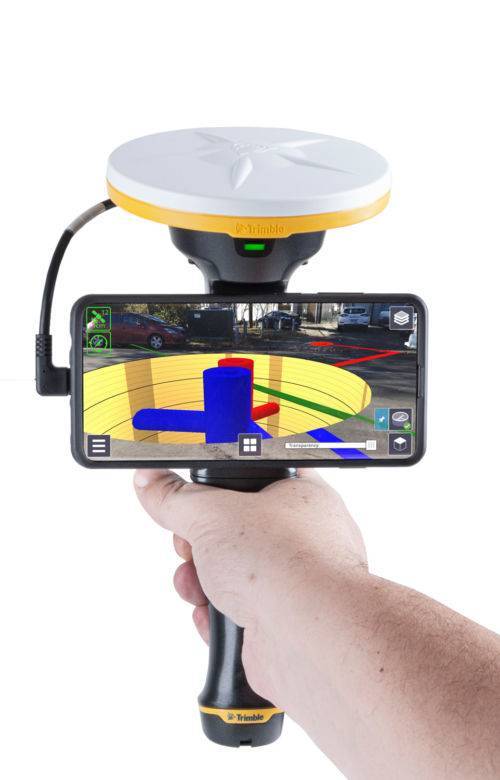 Trimble SiteVision is a user-friendly outdoor augmented reality system that brings data to life so you can visualize and explore complex information with unrivaled accuracy. Learn More Here.
 -
 The Trimble® T7 tablet is purpose-built for demanding survey and GIS applications. Featuring a powerful processor, Windows® 10 OS, large memory and a modern user interface, the T7 is a fast, reliable field computer for surveyors and GIS workers alike. Capturing data, visualizing and manipulating maps, and running office applications out on the job site is easy with the T7—and it’s all packaged in a rugged, compact, highly portable device. Contact us to learn more.
 -
Spectra Pro field software
Survey Pro provides you with a complete set of capabilities for all your survey projects. It’s fast, reliable and easy to use. Transfer data from Survey Pro to your laptop or PC and manage your jobs using Survey Office. Survey Pro software ships on Spectra Geospatial’s rugged line of data collectors providing unparalleled integration, data integrity, efficiency and ease-of-use. The features and functions of Survey Pro have been developed based on feedback from surveyors like you. Each new release of this software incorporates enhancements built on your field experience. Contact us to learn more. -
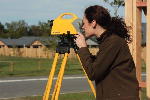
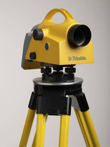 Trimble DiNi Level Digital Height measurement sensor - Trimble Quality and Accuracy for Measuring with Confidence. Contact us to buy or learn more.
- Determine accurate height information 60% faster than with automatic leveling
- Eliminate errors and reduce rework with digital readings
- Transfer data to the office easily
- Level Accuracy 0.3 or 0.7 mm
-
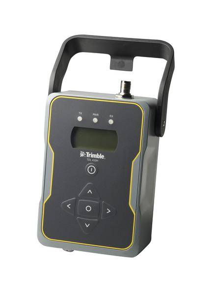
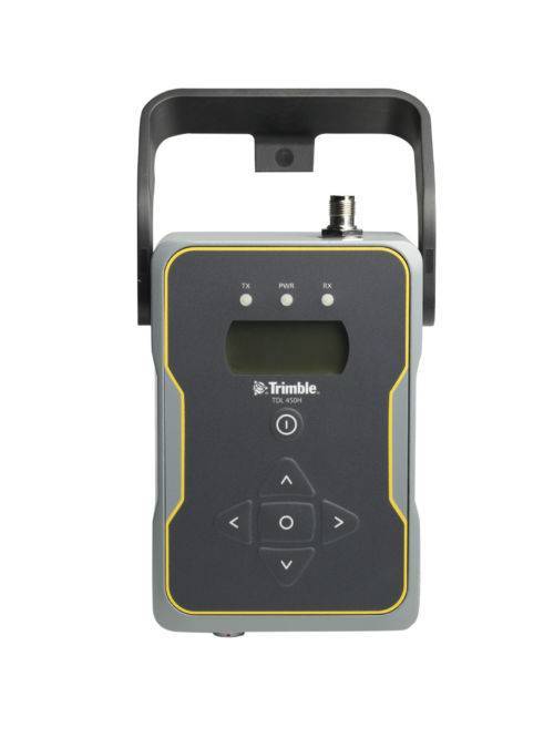 Designed to support all aspects of GNSS surveying, the Trimble TDL 450 UHF data radio offers flexible configuration options and rugged reliability.
 -
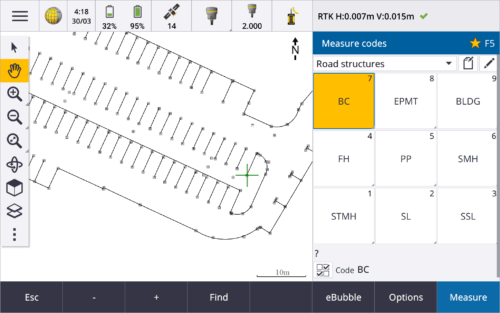
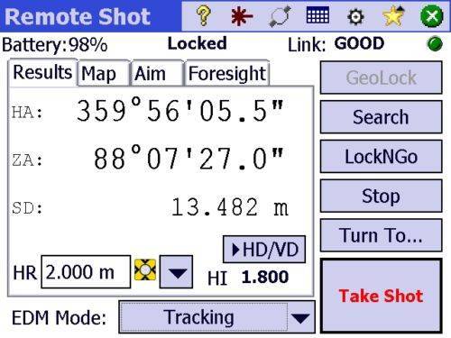
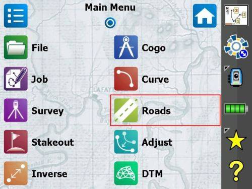
 Trimble Access™ software suite offers surveyors and geospatial professionals a range of specialized field applications designed to make fieldwork easier.
 -
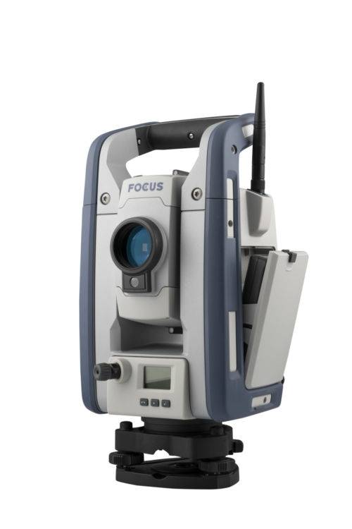
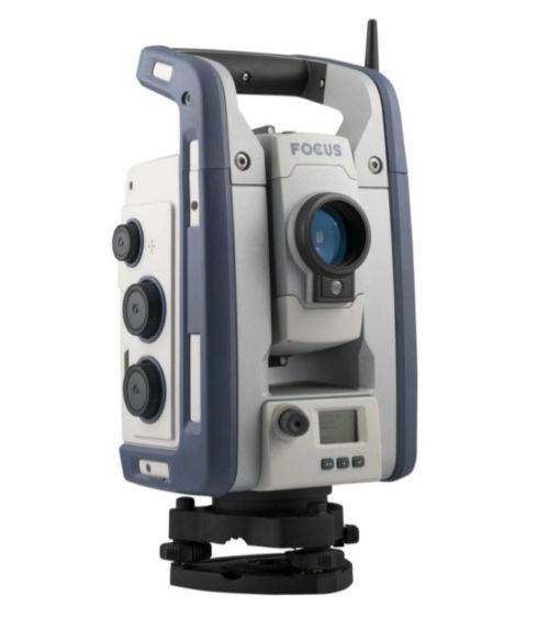 The Spectra Geospatial FOCUS 50 is the new robotic total station you can customize to fit your needs. Available in three models, with your choice of accuracy, the FOCUS 50 features the smoothness of MagDrive the stability of Autolock, and it is compatible with the latest Spectra Geospatial Origin software. Email us at [email protected] or Contact us to learn more https://www.seilergeo.com/wp-content/uploads/sites/9/2021/11/Spectra-Focus50-EN-1-1.mp4
 -

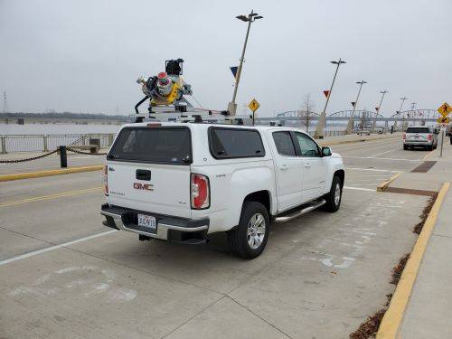
 The Trimble® MX50 is a practical field-to-finish mobile mapping solution for asset management, mapping, and road maintenance. The system delivers a very accurate point cloud of the environment along with complementary immersive imagery providing substantial gains in productivity. Contact your local Survey Sales Professional for a demonstration and full details.
 -
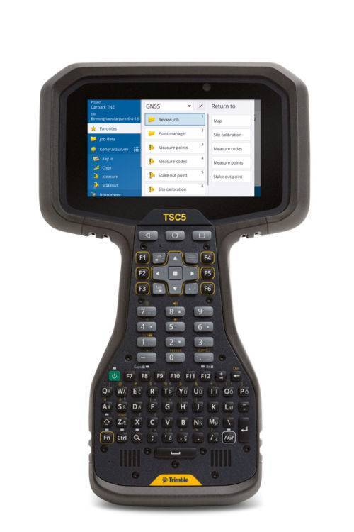
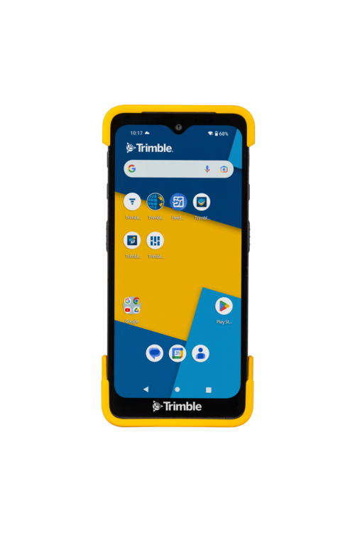
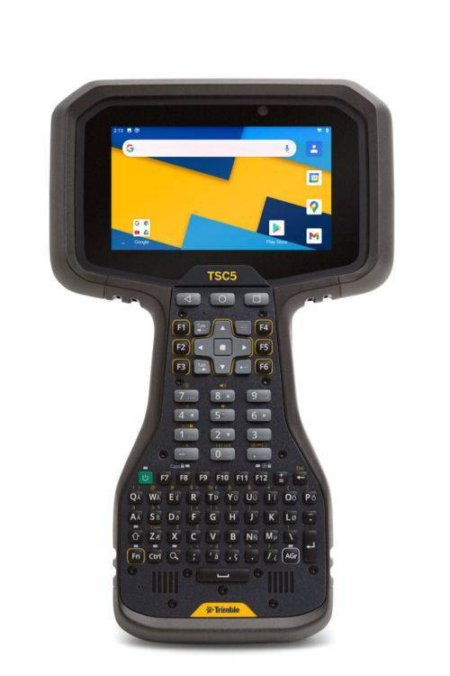 The Trimble® TSC5 controller is an Android-based survey controller featuring a five-inch screen and full keyboard—ensuring fast, efficient operation, even while wearing gloves. Rugged yet lightweight, with all-day battery power, the TSC5 is easy to carry and easy to use. Contact us for a demo today. The TSC5 is a new way to work - if you are familiar with the Trimble TSC3 controller, it’s been the mainstay of many surveyors’ field kit. The NEW Trimble TSC5 controller offers all the benefits of the TSC3, brought up to date with an Android operating system. Read more here!
 -
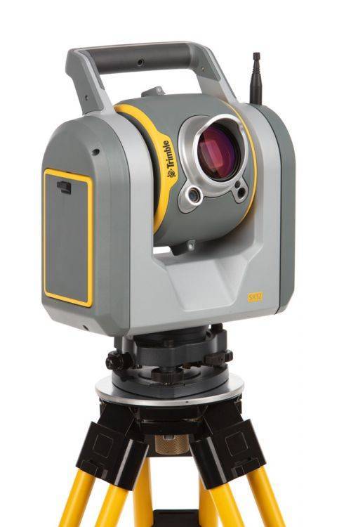
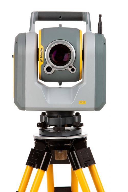
The Trimble SX12 Scanning Total Station merges high-speed 3D scanning, precision total station measurement, enhanced Trimble Vision and a green focusable laser pointer.
Note: Elevate Your Workflow to the Trimble SX12! Contact your Local Sales Professional Here to find out more about our exclusive trade-in details. Offer expires June 30th, 2024! Extended Capabilities; Do more when it matters the most. New green, eyesafe, focusable laser pointer yields the smallest spot size in the industry (just 3 mm at 50 m), so you can work from longer range and stay safe. The SX12 with Wi-Fi HaLow is the latest configuration See FAQ's here. The SX12 also comes in two configurations (with or without green laser) - Contact us for details. -
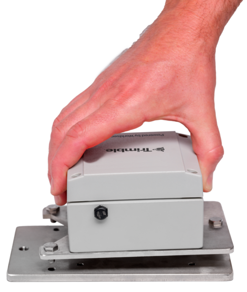
 Senceive remote condition monitoring technology enables precise, reliable monitoring in the most challenging applications. With a choice of two well-proven communication platforms you can deploy a wide range of sensors to deliver the insight you need. Both platforms enable you to deploy monitoring systems with no trailing cables and virtually no requirement for maintenance. Contact us for more information
 -
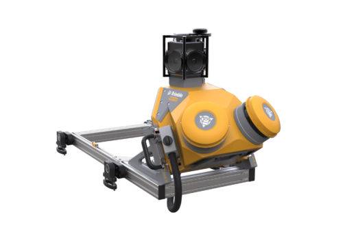
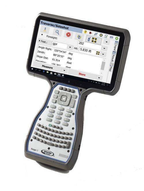 Welcome to the fourth generation Ranger data collector. Its all-new design is based on the experience gained over the last 18 years of demanding field operations. The guiding principles have never changed: productivity, reliability, and quality. A down day is simply not an option. The Ranger 7 continues the legacy of the Ranger data collector by focusing on what is important.
 -
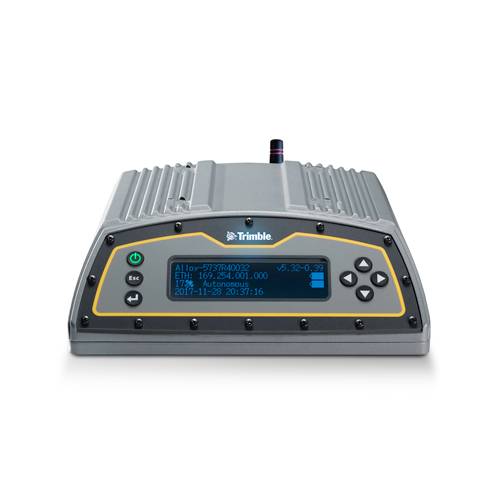 The Trimble Alloy™ reference receiver is ready to take on the requirements of any real-time network, in any environment, anywhere in the World. With tough IP68 housing, and modernized satellite tracking Trimble Alloy receiver can also be used as a campaign receiver for post-processing, as a Continuously Operating Reference Station (CORS) receiver or portable base station for Real-time Kinematic (RTK) applications – and even as a scientific reference station.
 -
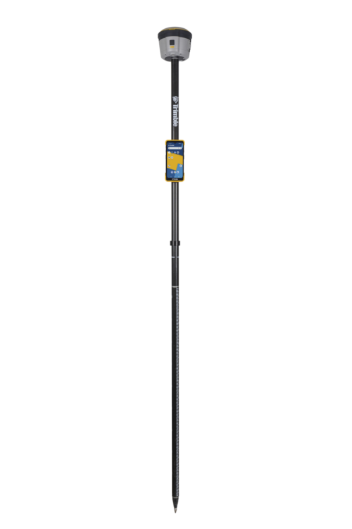
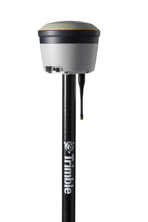
Trimble® R12i with Trimble ProPoint™ GNSS technology and new Trimble TIP™ tilt compensation
The R12i delivers unmatched GNSS performance, speed and accuracy to boost your productivity like never before. With improved performance in challenging GNSS conditions and robust IMU-based tilt compensation that lets you forget about leveling the pole, you'll get more done faster than you thought possible. Get the FAQs here! -
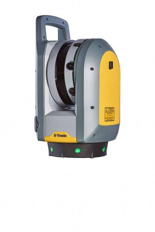
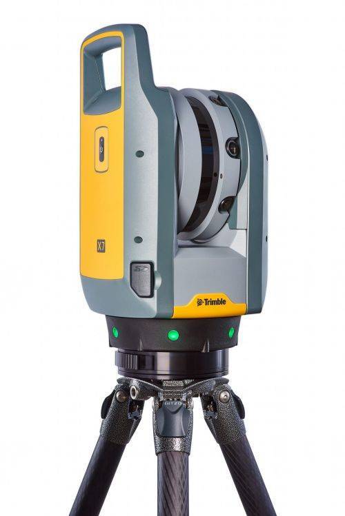
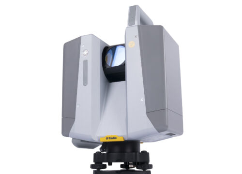
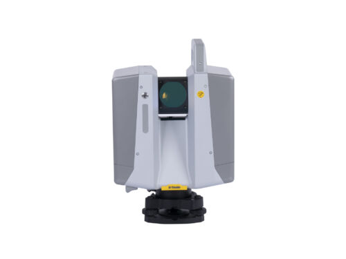
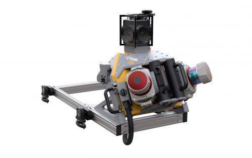
The Trimble® X7 High-speed 3D laser scanning system.
Key Features
- Automatic Calibration - Complete confidence in every scan with the industry's first smart calibration system. No targets or user interaction required.
- Self-leveling - Industry's first scanner to automatically level each scan with survey grade accuracy.
- Trimble Registration Assist - Increase your field productivity with the industry's most comprehensive automatic registration.
-
 Trimble Mobile MX9 LiDAR Mapping Imaging Solution is for Large-Scale Scanning and Mapping Missions. The MX9 is a complete field-to-finish mobile mapping solution combining state-of-the-art, advanced hardware with intuitive field software and a reliable, efficient office software workflow. Contact your local Survey Sales Professional for a demonstration and full details.
