-
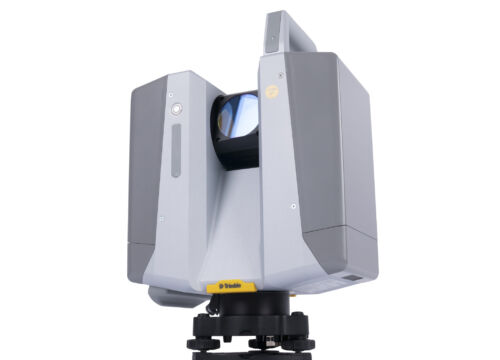
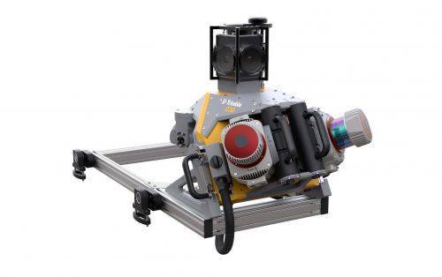
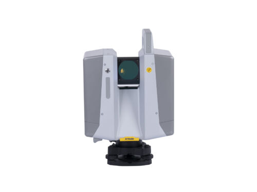 The Trimble X12 is a 3D laser scanner with the speed, accuracy, range and HDR imaging to capture the highest quality data available to produce impressive deliverables for demanding projects.
 -
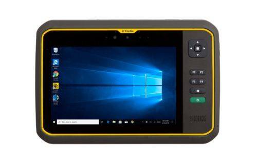 The Trimble® T7 tablet is purpose-built for demanding survey and GIS applications. Featuring a powerful processor, Windows® 10 OS, large memory and a modern user interface, the T7 is a fast, reliable field computer for surveyors and GIS workers alike. Capturing data, visualizing and manipulating maps, and running office applications out on the job site is easy with the T7—and it’s all packaged in a rugged, compact, highly portable device. Contact us to learn more.
 -
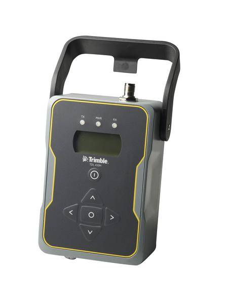
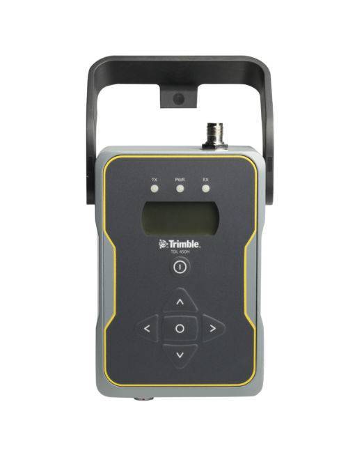 Designed to support all aspects of GNSS surveying, the Trimble TDL 450 UHF data radio offers flexible configuration options and rugged reliability.
 -
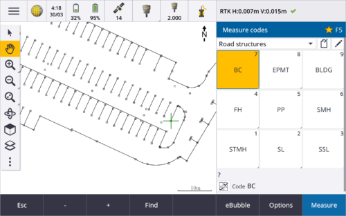
 Trimble Access™ software suite offers surveyors and geospatial professionals a range of specialized field applications designed to make fieldwork easier.
 -
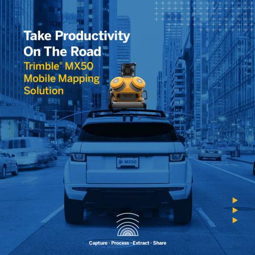
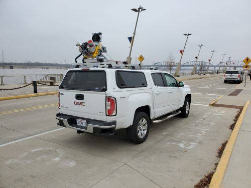
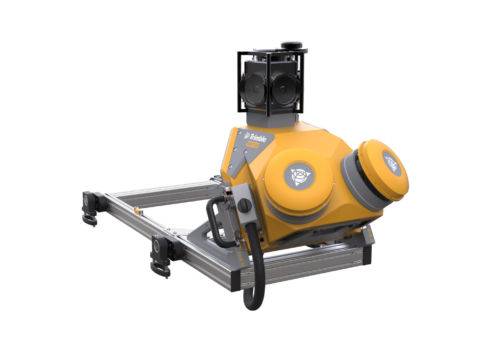 The Trimble® MX50 is a practical field-to-finish mobile mapping solution for asset management, mapping, and road maintenance. The system delivers a very accurate point cloud of the environment along with complementary immersive imagery providing substantial gains in productivity. Contact your local Survey Sales Professional for a demonstration and full details.
 -

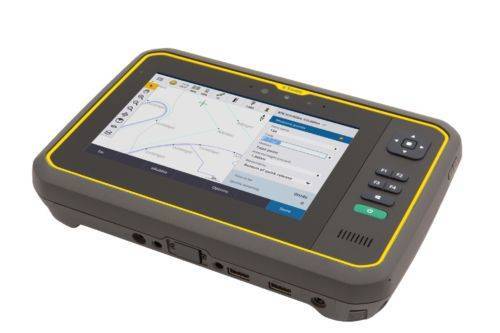
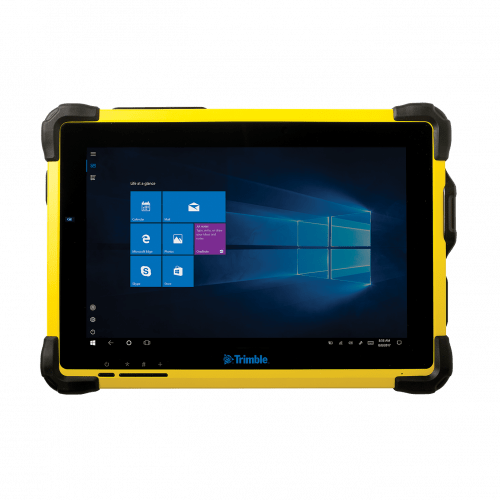
 You can depend on It. The T100 is Trimble’s latest high performance tablet. With a sleek, rugged design and 10-inch touchscreen you can read in any conditions, the T100 handles anything the work day dishes out. See full datasheet here. The T100 at a glance...
- Large 10.1-inch touchscreen.
- Full Windows desktop applications.
- Integrated long life battery.
- Ergonomic design.
- Expandable Trimble EMPOWER modules.
- Enjoy the convenience of an all day battery—for a full days work, every day.
-
 Trimble Mobile MX9 LiDAR Mapping Imaging Solution is for Large-Scale Scanning and Mapping Missions. The MX9 is a complete field-to-finish mobile mapping solution combining state-of-the-art, advanced hardware with intuitive field software and a reliable, efficient office software workflow. Contact your local Survey Sales Professional for a demonstration and full details.
 -
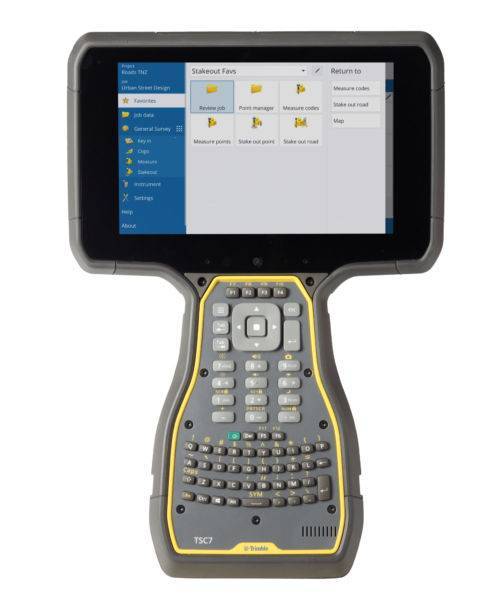
 The Trimble® T10 tablet brings the advantages of fast computing power and a large screen to the field. Combined with integrated GNSS capabilities, the T10 is a powerful, rugged device created for survey fieldwork, mapping, and GIS data collection and at the same time supports demanding desktop applications.
 -
 Trimble Business Center is Office Software for Surveyors. Contact us for a demonstration and/or quote. Complete your field to finish workflows and expand business opportunities with unique deliverables:
- Topographic base map creation for construction and land development
- Cadastral/ALTA drawings for boundary mapping
- Workflow automation through using templates and feature coding
- Perform Cut/Fill Map analysis, Corridor Design, Inspections and Volume Computations
-
 Trimble® TerraFlex™ is a flexible and easy-to-use cloud-based solution for field data collection that enables you to capture standardized, consistent data on your Android device. Add Trimble Catalyst to your TerraFlex field workflows to access high accuracy positions when and where you need them, using only a lightweight antenna that plugs into your Android smartphone. Contact your local Seiler GIS professional for details or purchase your TerraFlex software solution here.
 -
 The Trimble Indoor Mobile Mapping Solution (TIMMS) is the optimal fusion of technologies for capturing spatial data of indoor and other GNSS denied areas.
 -
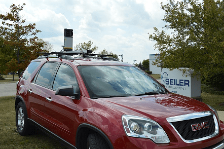
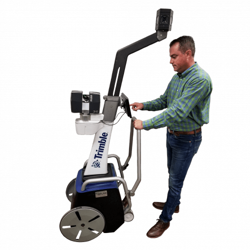
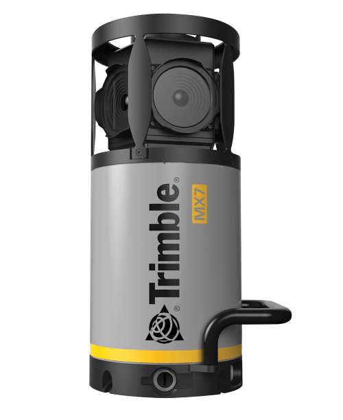 Contact us for details and special pricing! This demonstration unit has full warranty on hardware! The Trimble MX7 is a vehicle-mounted photogrammetric system equipped with six, 5 megapixel cameras, and Trimble Applanix GNSS and inertial geo-referencing modules. The Trimble MX7 can be deployed on vehicles of all sizes, letting you capture 30 MP geo-referenced images at highway speeds.
