-
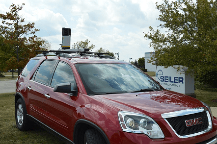
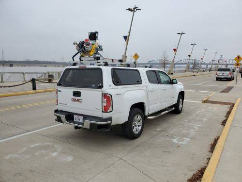
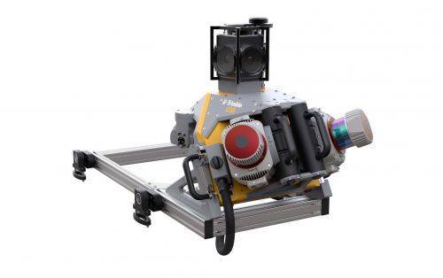
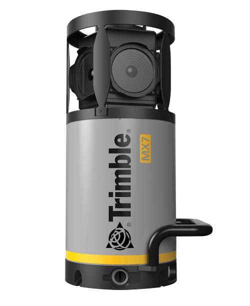 Contact us for details and special pricing! This demonstration unit has full warranty on hardware! The Trimble MX7 is a vehicle-mounted photogrammetric system equipped with six, 5 megapixel cameras, and Trimble Applanix GNSS and inertial geo-referencing modules. The Trimble MX7 can be deployed on vehicles of all sizes, letting you capture 30 MP geo-referenced images at highway speeds.
 -
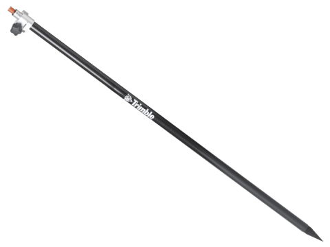 Markings offset by Trimble Standard target height (135mm) Carbon fiber and aluminum telescopic range pole - 2.6 meter. Accessory - Layout Rod - 2.6m Telescopic Rod
 -
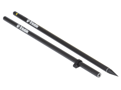 Accessory - Layout Rod - 2m Fixed Height Carbon Fiber Rod. Fixed height two part, 2 meter, carbon fiber range pole. P/N: 43169-10
 -
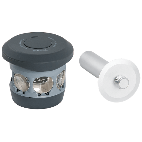 The 360 prism designed for Integrated Surveying with the Trimble R10 GNSS receiver. Compatible with all optical instruments. Request a quote - contact us. Accessory - RTS/RPT - 360 Prism includes height adapter to Trimble Standard target height (135mm).
 -
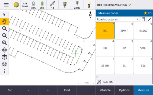
 Trimble Access™ software suite offers surveyors and geospatial professionals a range of specialized field applications designed to make fieldwork easier.
 -
 Trimble Business Center is Office Software for Surveyors. Contact us for a demonstration and/or quote. Complete your field to finish workflows and expand business opportunities with unique deliverables:
- Topographic base map creation for construction and land development
- Cadastral/ALTA drawings for boundary mapping
- Workflow automation through using templates and feature coding
- Perform Cut/Fill Map analysis, Corridor Design, Inspections and Volume Computations
-
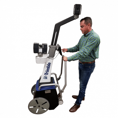 The Trimble Indoor Mobile Mapping Solution (TIMMS) is the optimal fusion of technologies for capturing spatial data of indoor and other GNSS denied areas.
 -
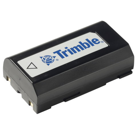 Accessory - MT1000, R6, R8, Dini Battery
 -
 Both active & passive tracking to locate and lock-on to the correct target
 -
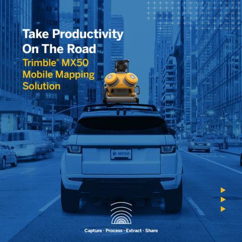
 The Trimble® MX50 is a practical field-to-finish mobile mapping solution for asset management, mapping, and road maintenance. The system delivers a very accurate point cloud of the environment along with complementary immersive imagery providing substantial gains in productivity. Contact your local Survey Sales Professional for a demonstration and full details.
 -
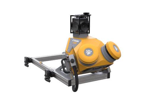
 Trimble Mobile MX9 LiDAR Mapping Imaging Solution is for Large-Scale Scanning and Mapping Missions. The MX9 is a complete field-to-finish mobile mapping solution combining state-of-the-art, advanced hardware with intuitive field software and a reliable, efficient office software workflow. Contact your local Survey Sales Professional for a demonstration and full details.
 -
 Accessory - RTS/RPT - Li-Ion Battery compatible for all S and X series (except X12) batteries and plus Focus 30, RTK, SPS.
