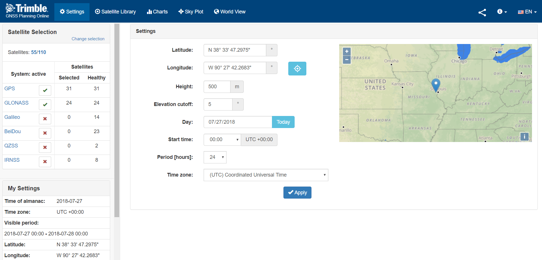
You can use this website to plan out your daily GNSS data collection projects.
It assists you in letting you see when the most satellites will be in view in your work area.
Select your location on the map or type in the Lat/Long, Day and Period of hours.
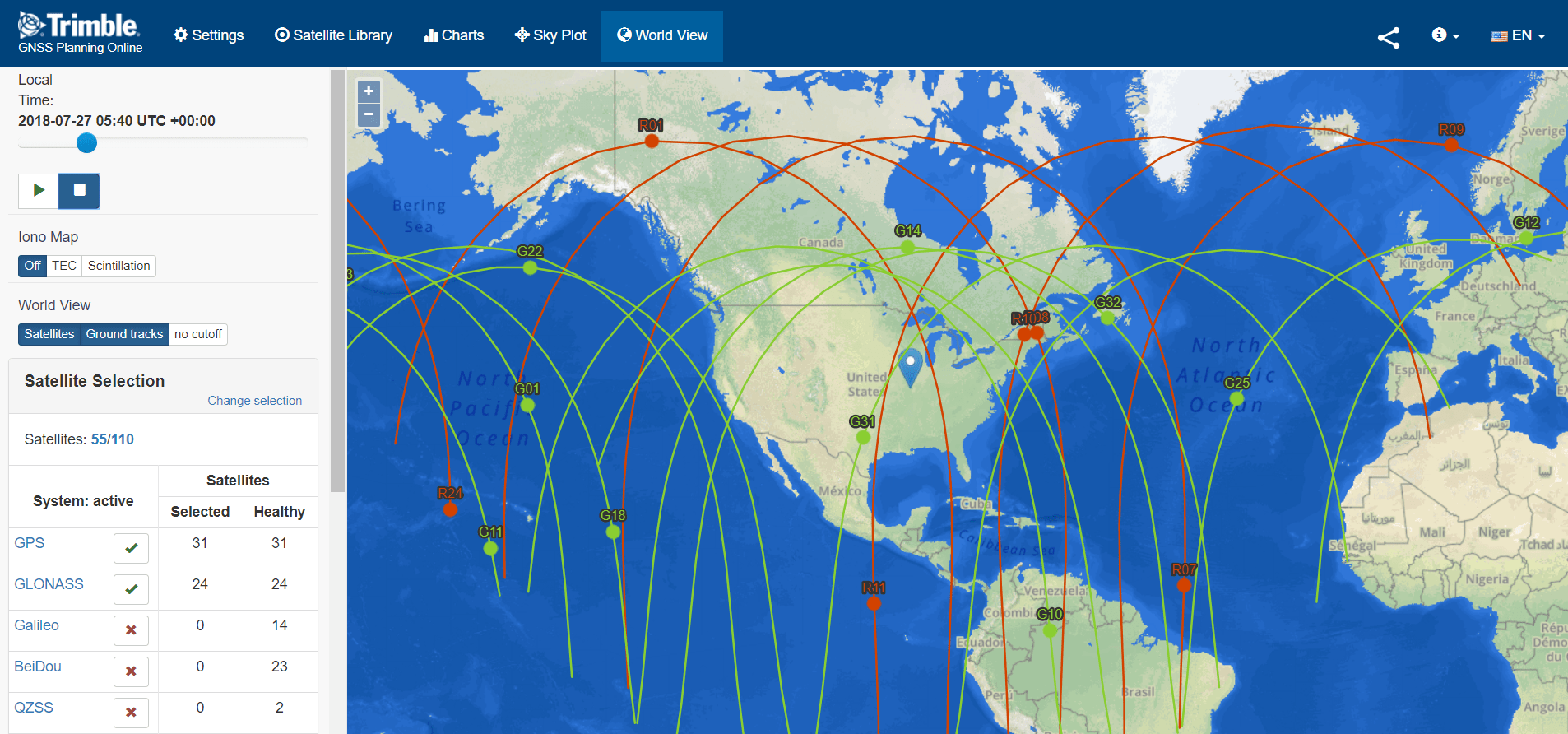
2. Then view the Satellites either in the Sky Plot or the World View.
Jay RiesterSenior GPS/GIS Application Specialist
Jay Riester is a Certified Trimble Mapping GNSS Trainer and has a Geography degree from UW-Oshkosh, WI - 1996. He has worked in the GIS/GNSS data collection industry for 29 years.
Since 2007, Jay has worked for Seiler Geospatial as a Sr. GPS/GIS Application Specialist providing to customers GNSS technical support and field solutions for both Trimble and Esri field applications.