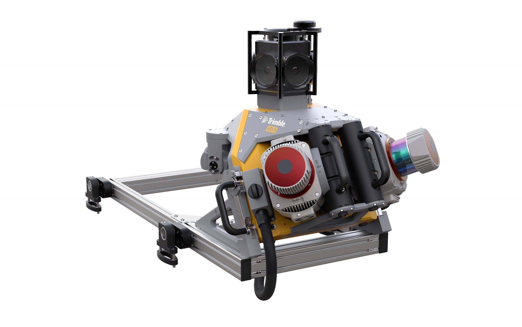
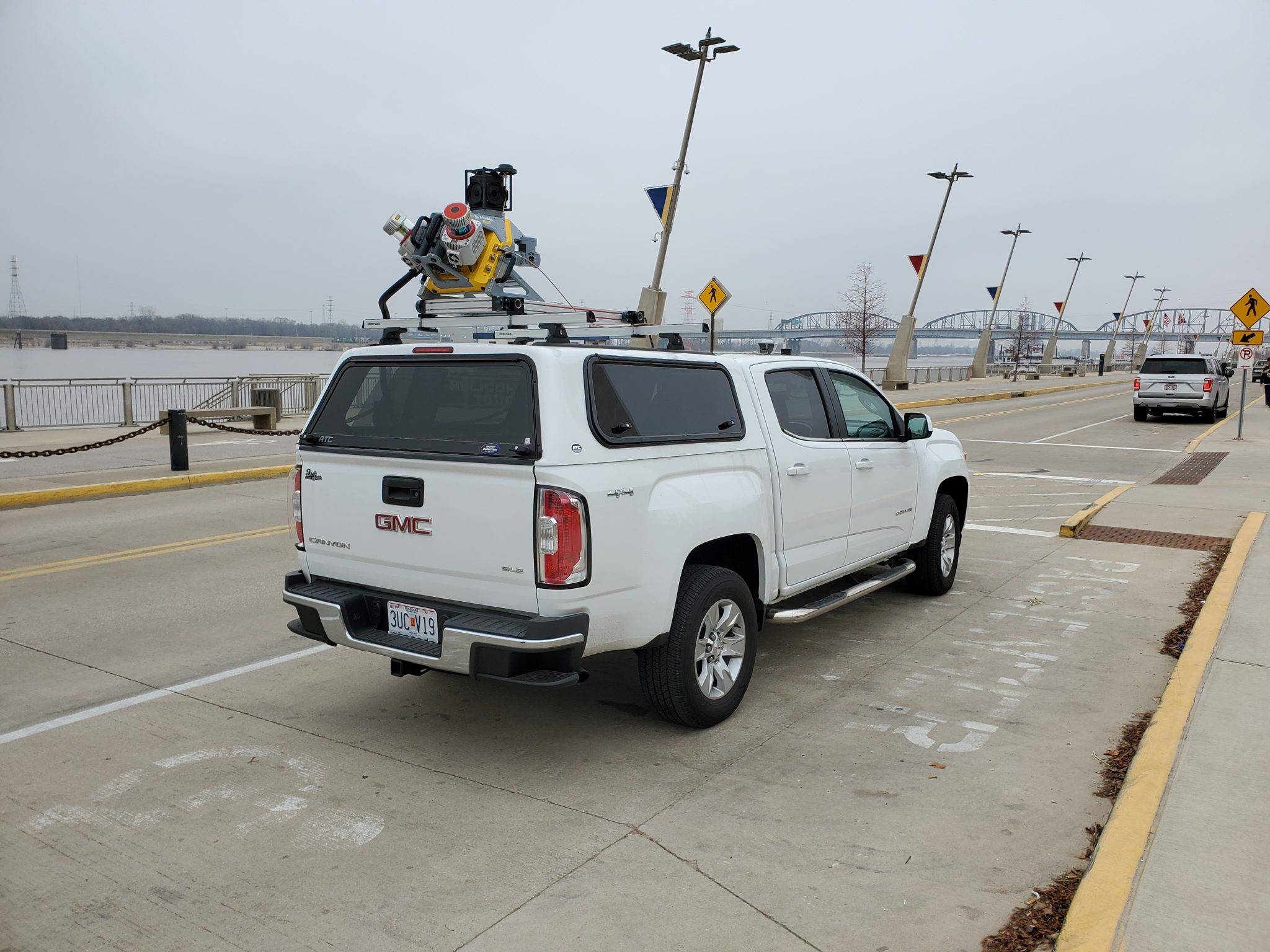

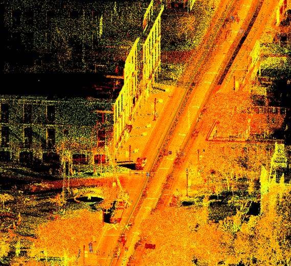
MX9 LiDAR Mapping Imaging Solution
The Trimble® MX9 is a state-of-the-art mobile mapping solution designed for large-scale scanning and mapping missions. Mounted on the roof of a vehicle, it rapidly captures high-density point clouds and immersive imagery at highway speeds, eliminating the need for road closures and enhancing safety. The MX9 integrates advanced GNSS and inertial technology with intuitive field software and powerful office software workflows, enabling efficient data capture, processing, and sharing. Ideal for transportation professionals, civil engineers, and city planners, the Trimble MX9 excels in applications such as road and rail asset management, telecommunication inventories, elevation models, and 3D city modeling.