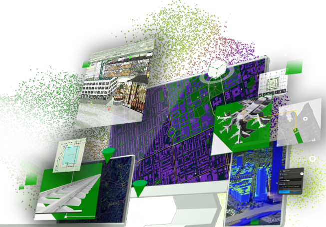
ArcGIS Online is Esri’s cloud-based GIS platform, offering powerful tools for mapping, spatial analysis, and data ...
Esri
Esri’s cloud environment, where Seiler builds all of the databases and apps for our clients.
At Seiler Geospatial, we offer a comprehensive suite of cloud-based software solutions designed to streamline data collection and management for geospatial professionals. Our offerings include Trimble® TerraFlex™, a flexible and easy-to-use solution that enables standardized, consistent data capture across various devices. We also provide GeoSync GO, a versatile geospatial framework for data visualization, capture, and management. Additionally, our FieldSeeker GIS software leverages the Esri® ArcGIS® Online platform, offering tools for plant occurrence assessment, bio-releases, chemical and mechanical treatments, and more, accessible from any web-enabled device. By integrating these cloud-based solutions into your workflows, you can enhance efficiency, accuracy, and collaboration in your geospatial projects.
Select the terms
Sort By
Esri
Esri’s cloud environment, where Seiler builds all of the databases and apps for our clients.
Esri
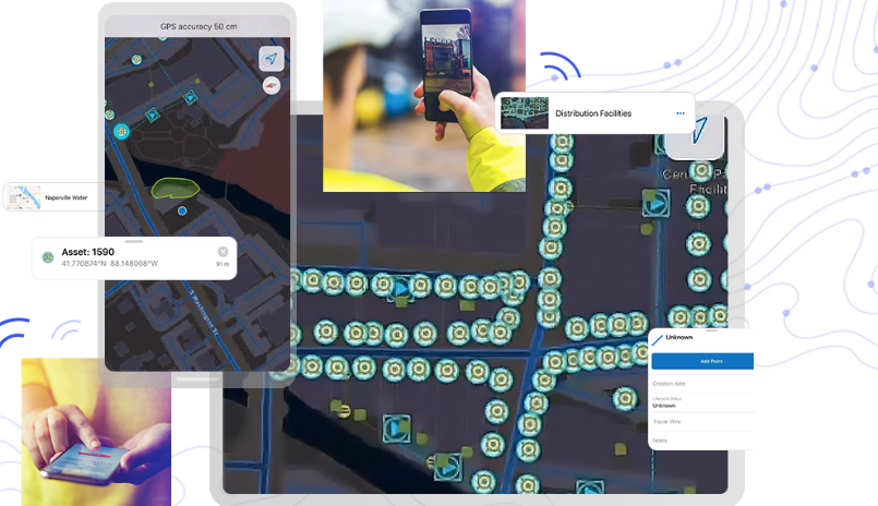
Mobile data collection app that is integrated with Trimble hardware solutions
Esri
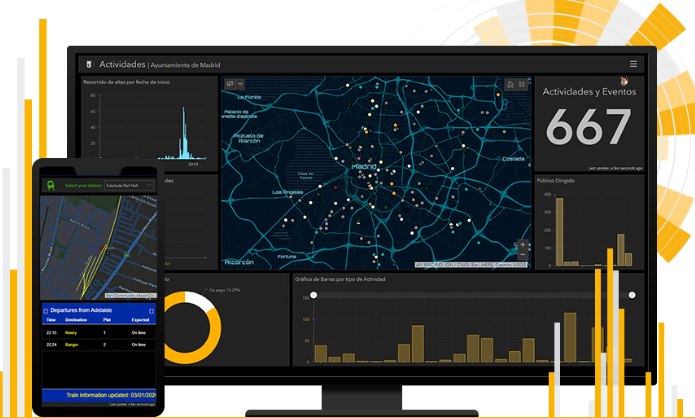
Map with dashboard capabilities for viewing data analytics. Created for users that need administrative views of data, project status, etc.
Esri
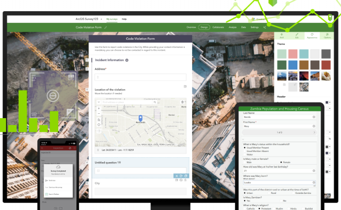
Survey form factor for collecting tabular data used when crowd sourcing & public outreach. Integrated with Trimble Hardware.
Esri
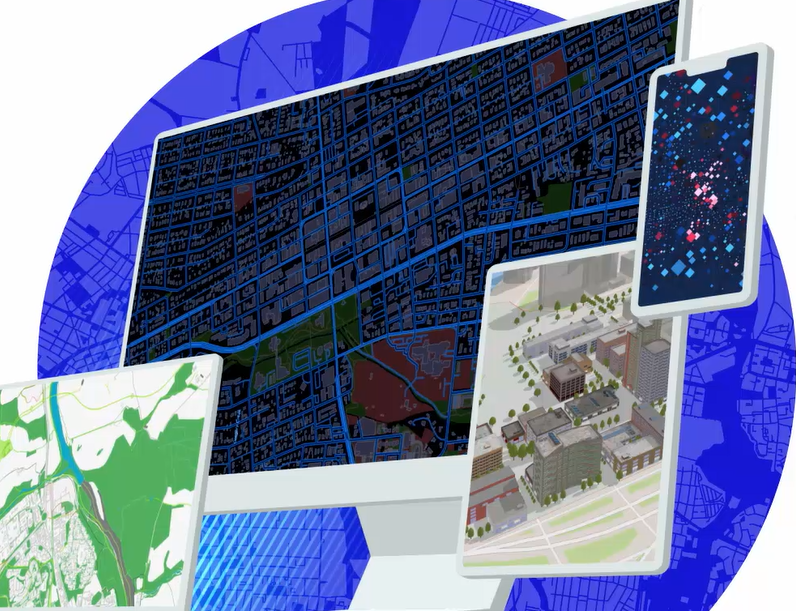
Autodesk integration for 3D visualization, Digital Twin apps and more.
Esri
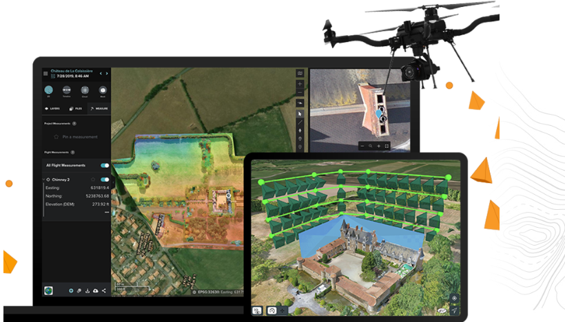
Drone planning, processing data, reality capture, etc

Esri
Interior 3D building plans for emergency management, office spaces, hotels & more.
Esri
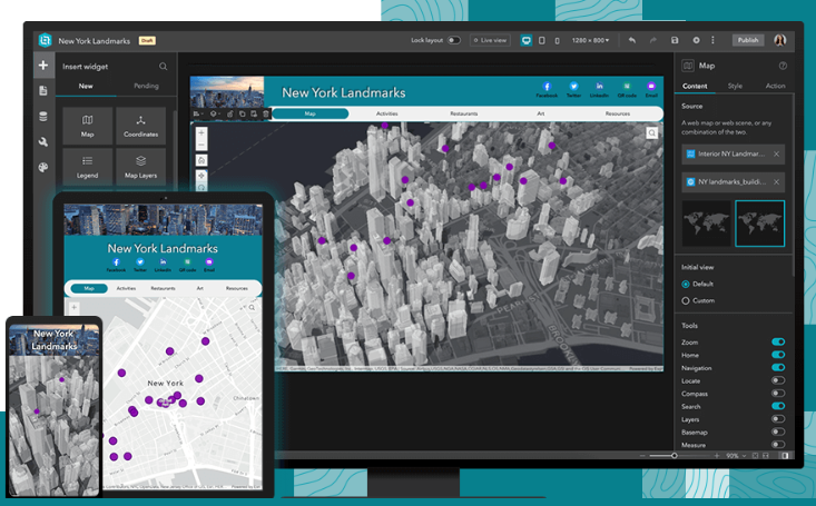
Web mapping application to view, edit, visualize data collected in the field or office
Trimble
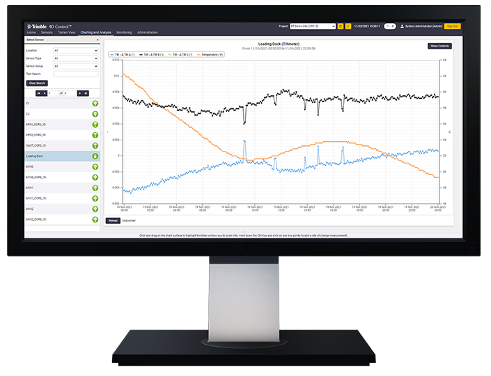
Unlock the full potential of your geospatial monitoring data.
Experience the future of surveying with our state-of-the-art products designed to boost accuracy and efficiency on every project. From advanced GNSS systems and robotic total stations to powerful software solutions like Trimble Access and Trimble Business Center, we offer the tools you need to excel. Don’t just take our word for it—see the difference for yourself. Request a demo today and discover how our innovative technologies can transform your surveying capabilities.
"*" indicates required fields