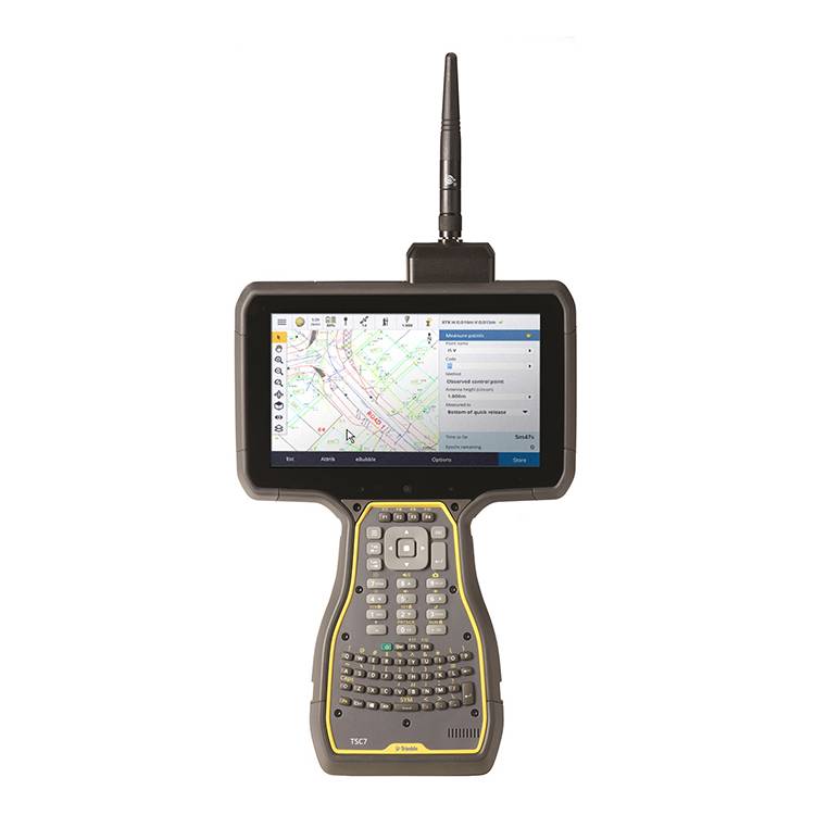
Trimble
Combines the power of a tablet, laptop and rugged field controller.
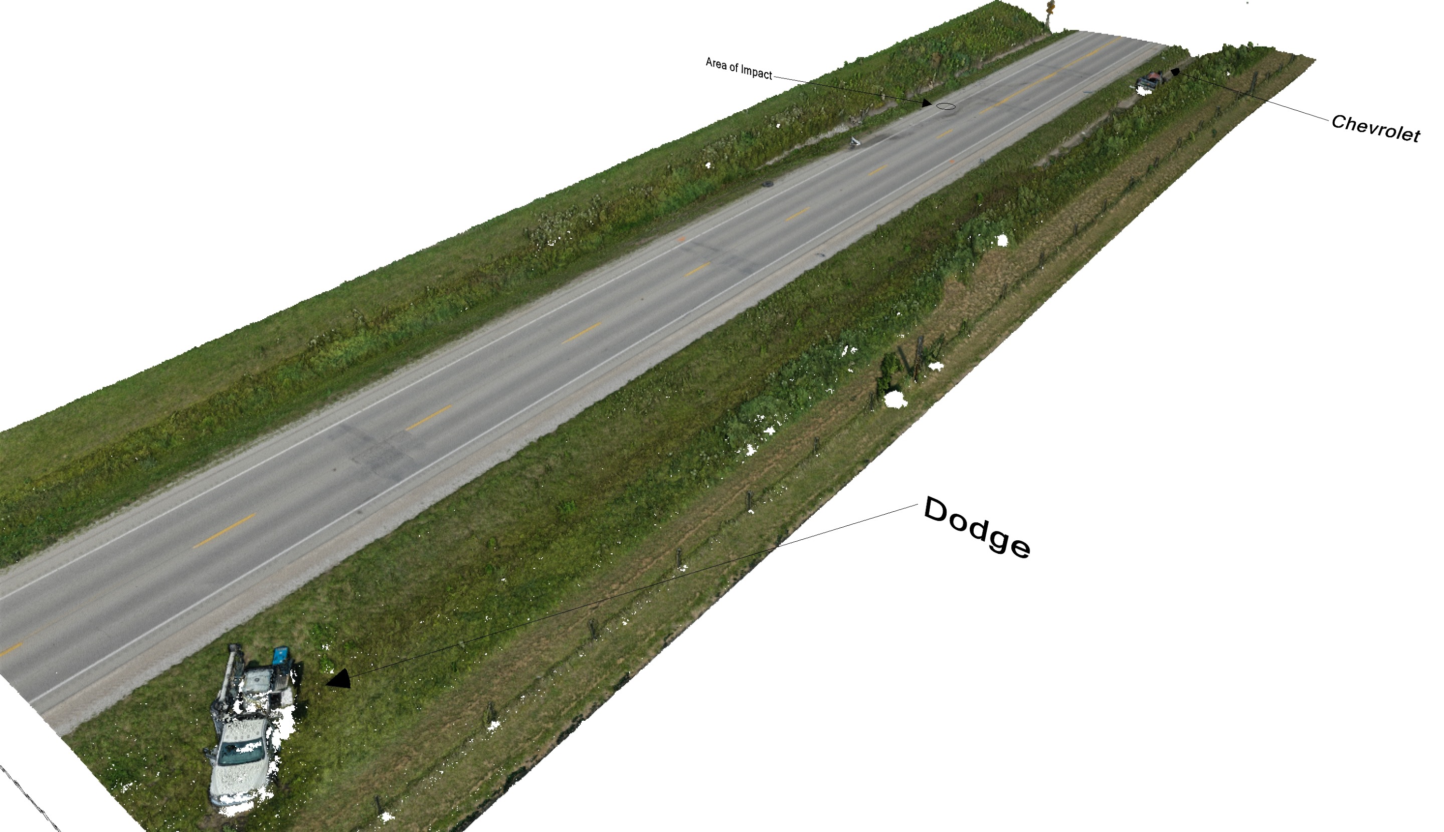
Seiler Geospatial offers advanced solutions for collision reconstruction within the public safety sector. Our high-precision tools, such as 3D laser scanning, GNSS receivers, and photogrammetry systems, enable investigators to accurately capture accident scenes. This data allows for detailed analysis and modeling of crash dynamics, helping to reconstruct events with remarkable precision. With Seiler Geospatial’s technology, collision reconstruction specialists can improve the accuracy of their findings, enhance safety in the field, and ensure reliable, defensible evidence for legal proceedings and accident analysis.


Trimble
Combines the power of a tablet, laptop and rugged field controller.
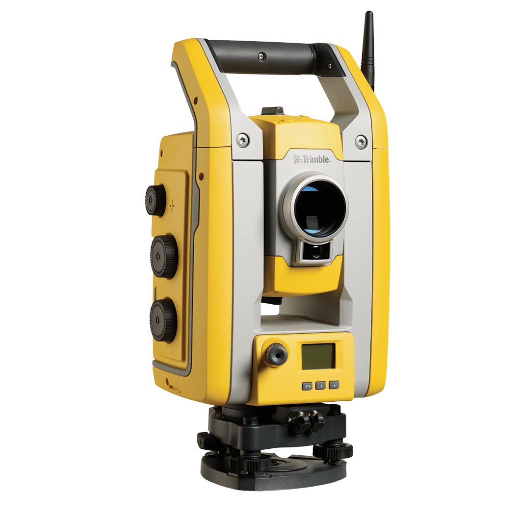
Trimble
Efficient surveying with Trimble SurePoint™, MagDrive™, and DR Plus EDM for high accuracy.
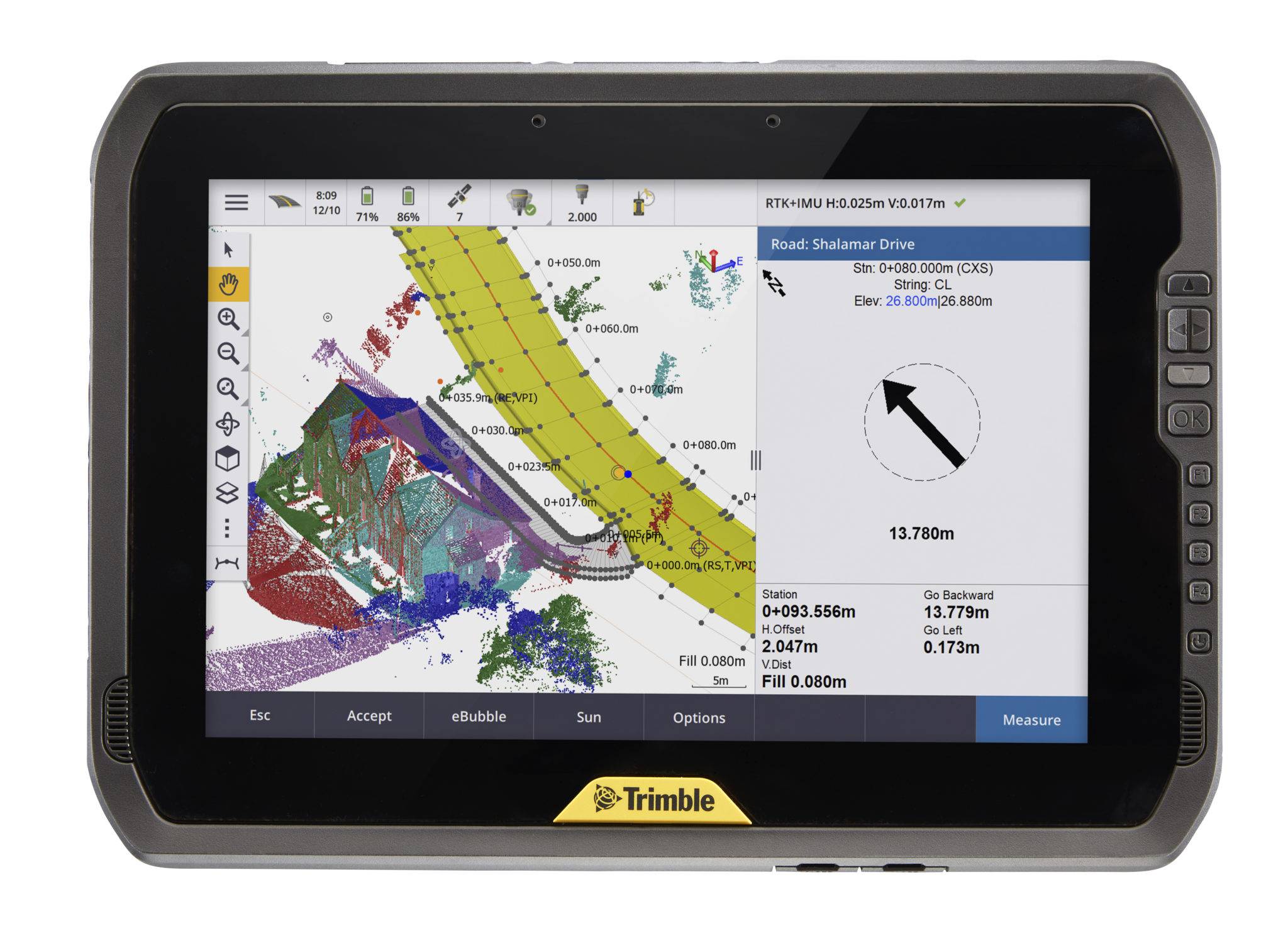
Trimble
Sleek, rugged 10-inch tablet that you can read in any condition.
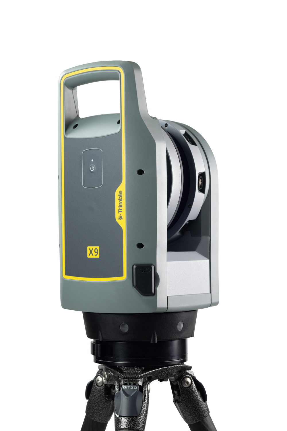
Trimble
Offering the range, accuracy, scan times and sensitivity you need to do more, better, and faster.
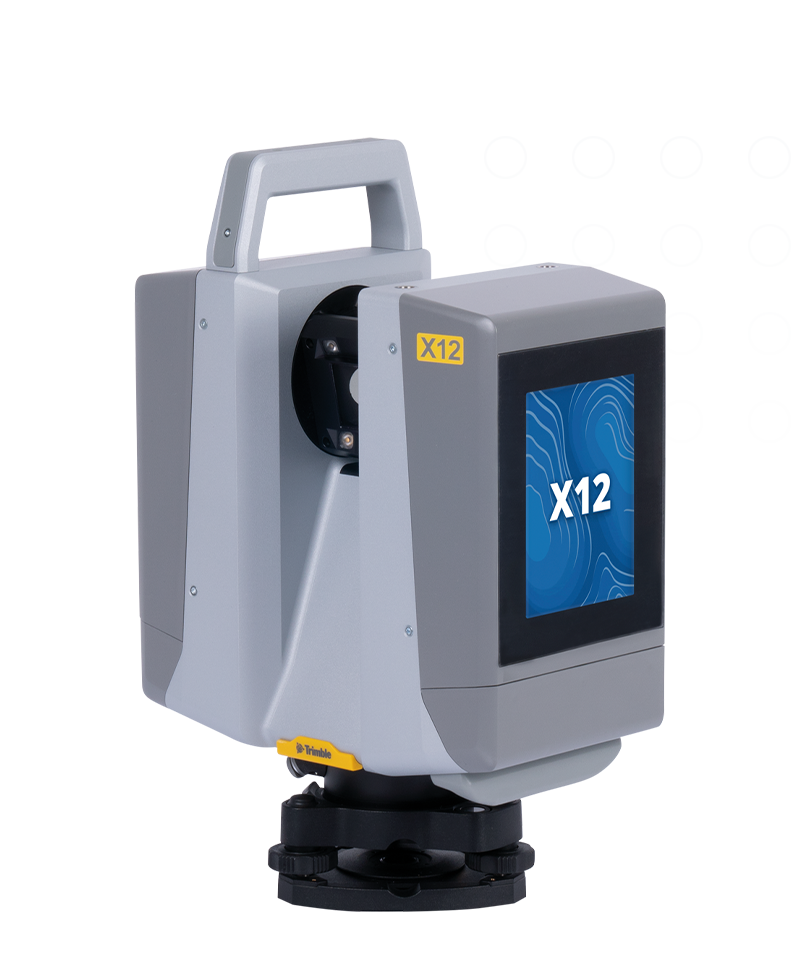
Trimble
High-end laser scanning with exceptional speed and range combined with laser-focused accuracy and imagery.
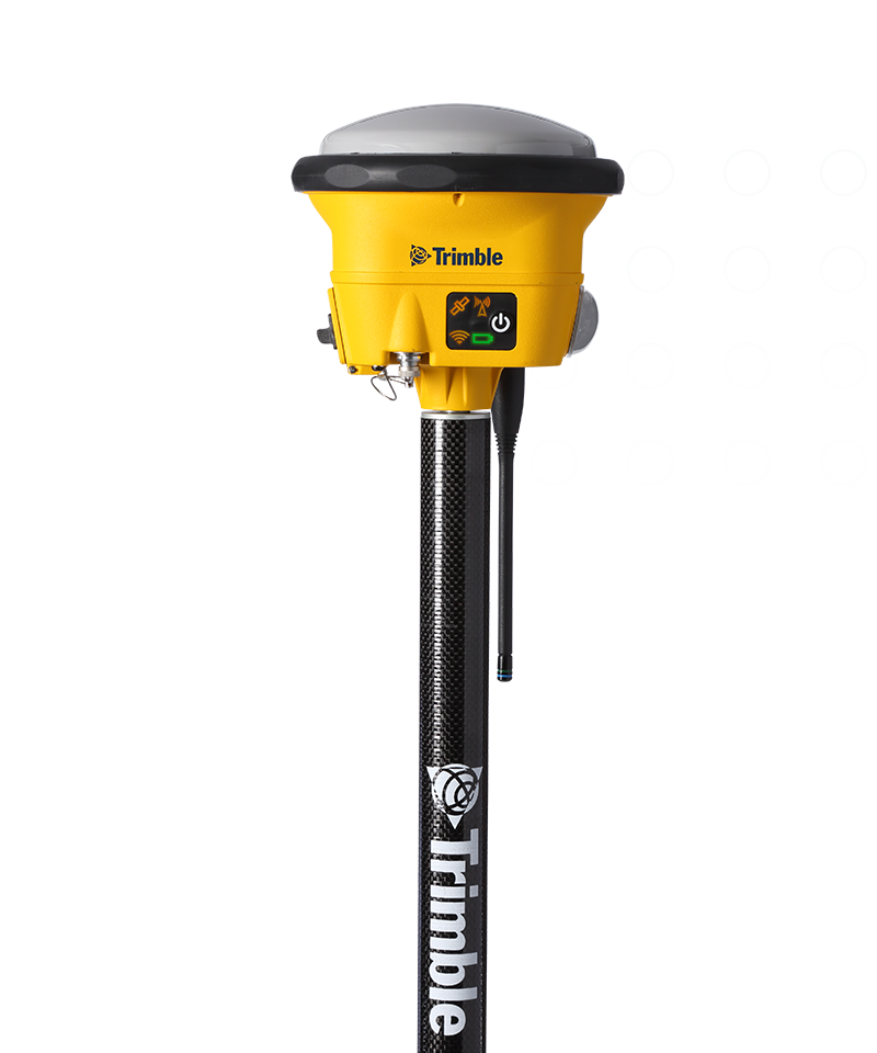
Trimble
A rugged, high-accuracy GNSS receiver with tilt compensation and scalable performance.
$3,160.00
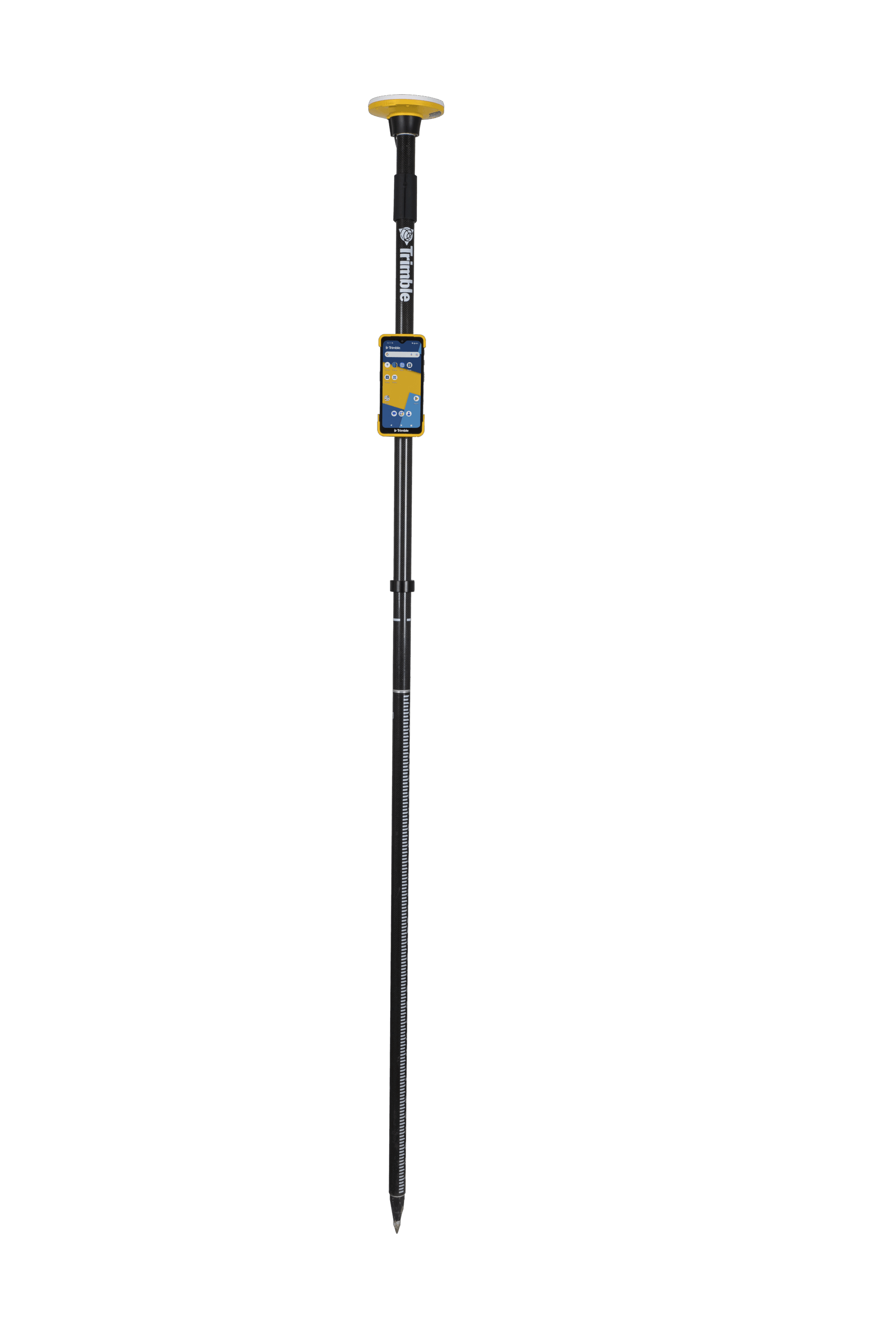
Trimble
Integrates advanced hardware and software to streamline field operations and enhance data accuracy.
Trimble
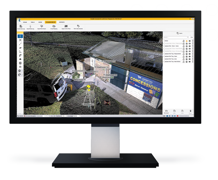
Trimble® Forensics Reveal is powerful CAD software built for investigators, enabling precise scene reconstruction, analysis, and courtroom-ready visuals. Ideal for crash and crime scenes, it simplifies complex data into clear, professional results.
Discover how Seiler can help optimize your project. Contact us to learn more or request a demo.