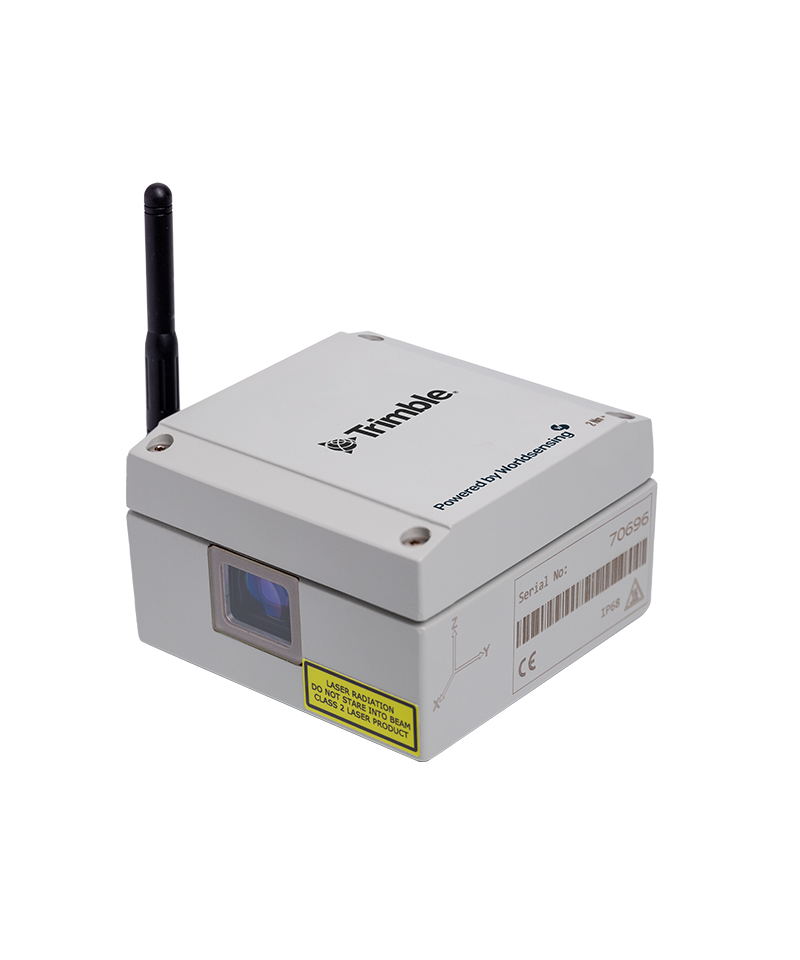
Home Trimble Tiltmeter

Tiltmeter

The Trimble Worldsensing Tilt90 is a state-of-the-art wireless tiltmeter designed for precise geotechnical and structural monitoring. This compact, robust device combines a 3-axis MEMS accelerometer with long-range wireless communication, making it ideal for applications such as landslide detection, bridge and tunnel monitoring, railway track alignment, and excavation stability assessments

Category: Brand:

Key Features

  • High-Precision 3-Axis Tilt Measurement: Measures inclination across three axes with a full ±90° range. Accuracy varies with tilt angle: ±0.0025° within ±2°, up to ±0.23° near ±85°, ensuring reliable data across a broad range of applications.
  • Wireless Data Transmission: Utilizes LoRa communication technology to transmit data over distances up to 15 km (9 miles) in open environments, reducing the need for extensive cabling and infrastructure.
  • Long Battery Life: Powered by replaceable C-size batteries, the Tilt90 can operate for over 10 years with a 1-hour sampling rate, minimizing maintenance requirements.
  • Rugged and Weatherproof Design: Encased in an IP68-rated housing, the device withstands harsh environmental conditions, operating reliably between -40°C and +80°C (-40°F to 175°F).
  • Flexible Antenna Options: Available in two models: LS-G6-TIL90-X with an external antenna for maximum range, and LS-G6-TIL90-I with an internal antenna, suitable for applications where external components may be at risk.
  • Integrated Data Logging: Features onboard memory capable of storing up to 140,000 readings, including timestamps and 3-axis data, ensuring data integrity even during communication outages.
  • User-Friendly Configuration: Easily set up and manage using the Worldsensing Android app, which allows for sampling rate adjustments, firmware updates, and real-time data access.


Applications

  • Structural Health Monitoring: Tracks deflections and movements in bridges, buildings, and other infrastructures, aiding in the assessment of structural integrity.
  • Geotechnical Monitoring: Monitors slope stability, embankments, and excavation sites, providing early warnings for potential landslides or ground movements.
  • Railway Infrastructure: Assesses cant, twist, and vertical alignment of tracks, ensuring safe and efficient railway operations.
  • Tunneling and Excavation: Detects ground movements induced by tunneling activities, helping to mitigate risks associated with underground construction.