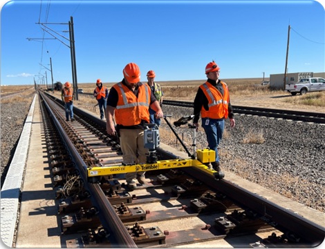
Rail

The future of rail begins with precision. Seiler Geospatial, in partnership with Trimble, delivers advanced rail measurement and monitoring solutions that support every phase of the rail lifecycle—from planning and construction to maintenance and modernization. Trimble GEDO systems combine powerful field hardware with intuitive software to deliver millimeter-level accuracy, reduce downtime, and streamline data across complex rail networks. Whether it’s slab track construction, tamping support, or real-time clearance analysis, Seiler’s rail solutions help ensure your infrastructure stays on track, on time, and built to last.
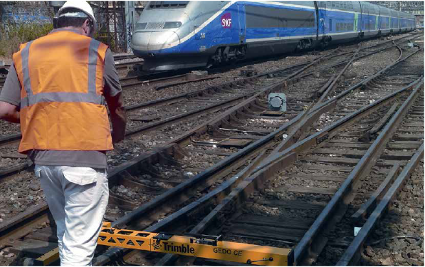
Rail Measurement and Monitoring That Keeps You on Track

Seiler Geospatial delivers Trimble GEDO solutions that support the full lifecycle of rail infrastructure—from design and construction to inspection and maintenance. With fast, accurate data collection, automated workflows, and real-time analysis, our rail solutions help ensure precision, safety, and efficiency across every mile of track.

Construction Monitoring

Seiler geospatial equipment provides precise, real-time data on track alignment, bridge integrity, and overall infrastructure, enabling engineers to quickly identify and address issues. Advanced sensors, high-resolution imaging, and robust GPS systems support accurate measurements under challenging conditions, enhance predictive maintenance, and ensure compliance with regulatory standards throughout the project lifecycle.

Track Survey

In rail track surveying, accuracy and efficiency are paramount. Seiler geospatial equipment delivers precise data on track geometry, alignment, and gradients through advanced sensors, high-resolution imaging, and integrated GPS systems. This technology quickly detects deviations and potential issues, streamlining maintenance planning and ensuring regulatory compliance throughout the track lifecycle.

GEDO Systems Built for Rail Precision

From the GEDO Rec and GEDO Vorsys systems for data collection and georeferencing to GEDO Scan for clearance analysis and as-built documentation, these tools enable seamless field-to-office workflows.
Please contact us to learn more about related product solutions.

Get Started Today

Discover how Seiler can help optimize your project. Contact us to learn more or request a demo.