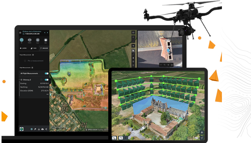
Site Scan for ArcGIS
Site Scan for ArcGIS is Esri’s all-in-one, cloud-based solution for drone flight planning, data capture, processing, and analysis. Built for industries like construction, infrastructure, and environmental monitoring, it delivers high-accuracy 2D and 3D outputs—orthomosaics, point clouds, 3D meshes, and more.
Plan flights with precision, manage drone fleets, and process imagery in the cloud with automated tools. Results can be easily shared via ArcGIS or integrated with platforms like Autodesk BIM 360, making collaboration seamless across teams.
Key Benefits:
- Smart flight planning with terrain awareness
- Fast cloud processing of 2D/3D imagery
- Tools for measurement, volume, and change detection
- Built-in fleet and pilot management
- Direct ArcGIS and Autodesk integration
Site Scan empowers teams to turn drone data into actionable insights—all in one platform.