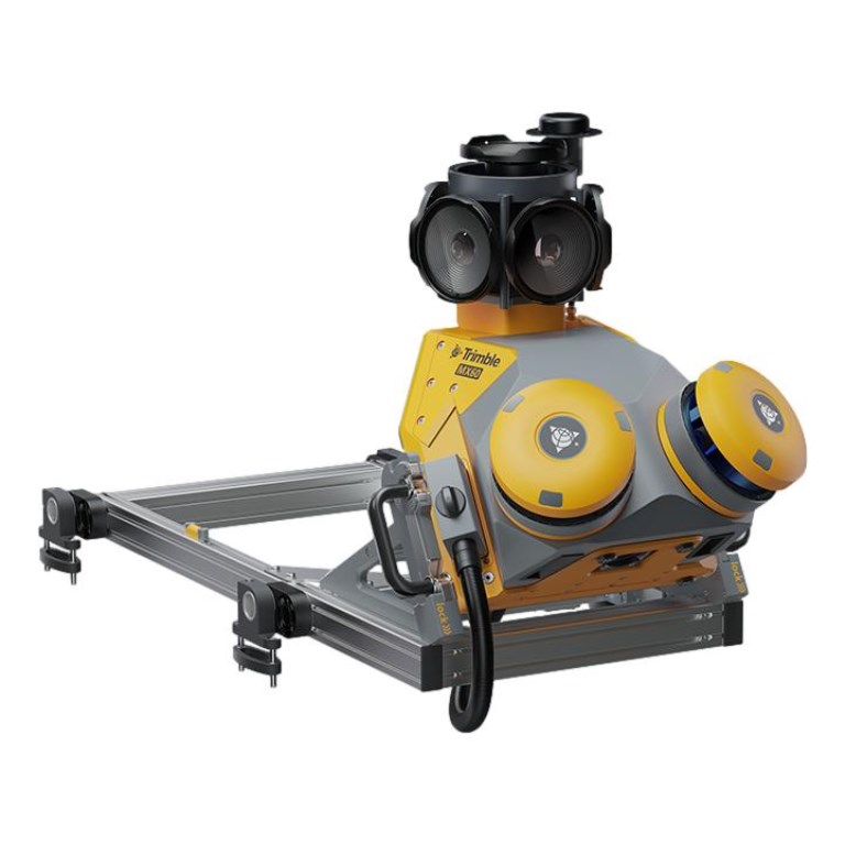
MX60
The Trimble MX60 is a high-performance mobile mapping system that combines advanced LiDAR scanning, 360° panoramic imaging, and precise GNSS-inertial positioning to deliver accurate, efficient asset data collection for infrastructure and road management projects.