Since the early days of satellite-based surveying, geospatial professionals have struggled to get centimeter-level accuracy when working on remote sites. Enter real-time kinematic (RTK) and real-time GNSS networks (RTN), both providing centimeter-level positioning in real time. In a recent article in America Surveyor, Trimble’s Mark Richter looks at the limitations of RTK and RTN and early precise point positioning (PPP). Richter describes how these technologies paved the way for CenterPoint RTX, a vastly improved satellite-delivered positioning service built on RTX technology and achieving horizontal accuracy of 2 cm or better with a convergence time of 15 minutes worldwide and one minute in many locations in Europe and North America.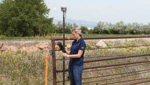
One early adopter used the increased accuracy to help local officials in Australia enhance the accuracy of a digital cadastral database. To find out more about this project as well as CenterPoint RTX, read the full article here.
