In Trimble Access version 2020 or higher, a feature was added to allow the user In RTK surveys, to measure points with independent subsets of the currently tracked GNSS satellite constellation. This allows for consecutive measurements to be independent of each other, without having to revisit the point after a significant period of time to ensure the constellation has changed. The SV subset function divides all tracked SVs into two subsets with an even spread throughout the sky and can be used to make an occupation independent without having to return at another time. The SV subset function is available from the Satellites screen or the RTK Initialization screen.
We recommend people build redundancy and independent checks into GNSS measurements when measuring important GNSS points. Typically, that means measuring the point then either moving the rod off the point, breaking initialization, initializing away from the point to be collected and using the Observed control point method to insure there is enough time and enough epochs to check the initialization. Another method is to measure the point then come back in a different satellite constellation, wait at least 30 minutes, and measure the point again. This new feature does both of these methods and more to speed up measurement windows and build in independent checks.
Procedure
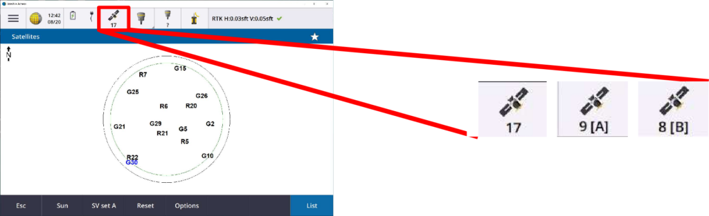
Users can select the SV subset from the Satellite screen or the RTK initialization screen. To open the Satellite screen, tap on the satellite icon (shown with the number of satellites available) on the top status bar.
![]()
After opening, you have the option of a List or sky Plot view, shown in the bottom right.

Use a softkey at the bottom of the screen to change to the SV set A.
- Tap the screen softkey
- Use the keyboard only, press Ctrl button then the corresponding keyboard number of the desired softkey
If you see SV set A, tapping it will activate that subset.
The softkeys work as a toggle with three choices: SV set A, SV set B and All. The softkey does not reflect the currently active mode, it shows what subset it will change to.
The Satellite # on the Status bar show what is currently active satellite set selection.
Reset Initialization or Satellite subset
Another way to select or reset the Satellite subset is to use the RTK initialization screen
In a survey, tap Menu → Measure → RTK Initialization

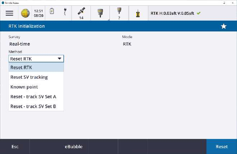
Change the Method to the Subset you want to use then tap Reset. This will change the tracked subset, reset the current initialization and start the new initialization.
Note: If you do not see a selection list in the method, there is a measurement active on another screen. Close any active measurements to use this feature.
Adding the switch to a Data Collector Function Key
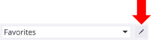
Use the Favorites Edit to add the Select satellite subset to a Function key for fast changes.
Tap Menu → pencil to edit the current group
Toggle to edit the Function keys
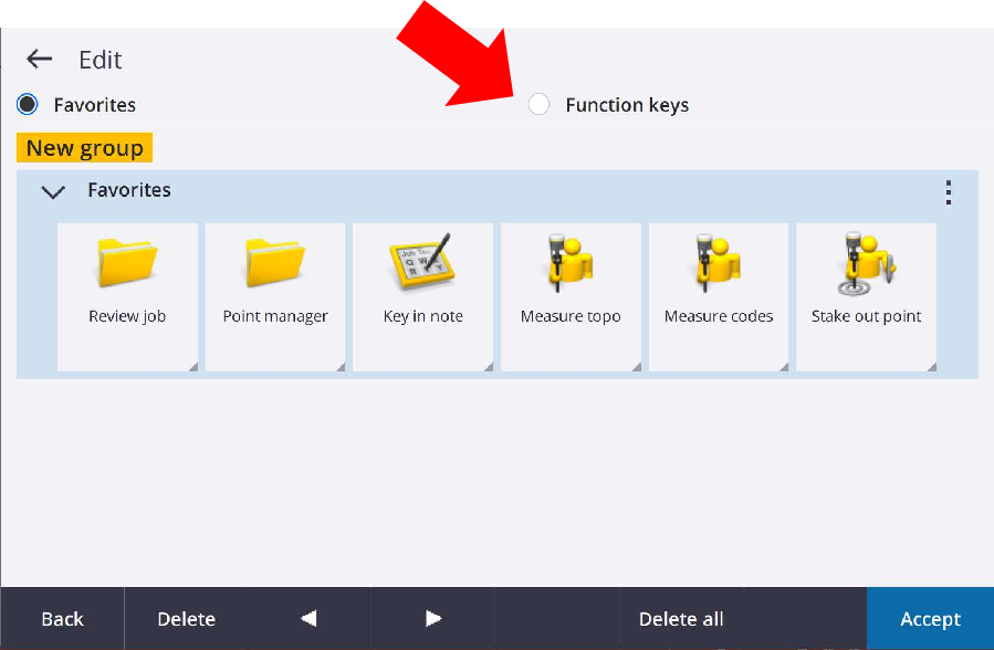
Tap the # key to assign

From the survey actions, select a command to preform for that function key.

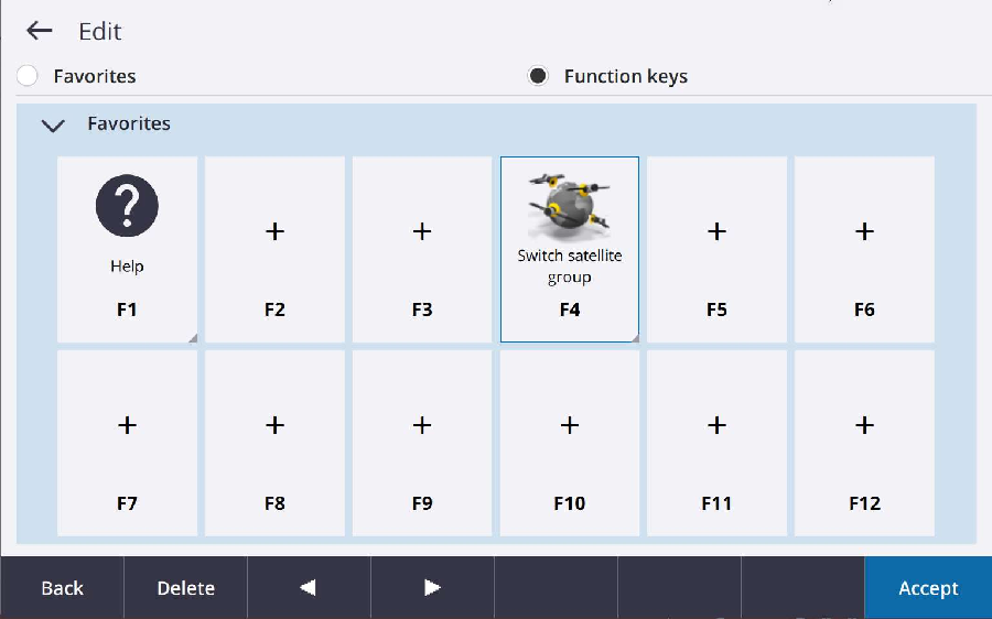
Now, unless you are actively in a measurement, tapping the assigned function will toggle between ALL, SV set A, and SV set B.
View the original Survey Technical Support Notes: Trimble Access – Selecting Satellite Set