Trimble ASCII File Generator Utility

By
| () | Mapping & GIS, Survey

Learn how to use the Trimble ASCII File Generator Utility Program which allows users to apply style sheets to Trimble Access/Trimble Survey Controller JobXML or job files in order to create custom export formats or reports on your office computer.

Installing

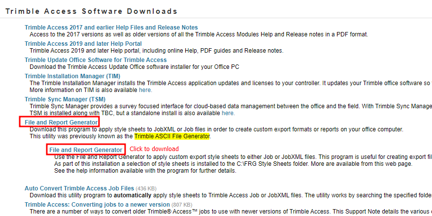
From your computer, open a web browser (Chrome, Firefox, etc.) and go to Trimble Access Software Downloads.
Download and install the File and Report Generator, a.k.a. Trimble ASCII File Generator Utility.

Screenshot of the Trimble Access Software Downloads webpage, highlighting the ASCII File Generator Utility

Usage

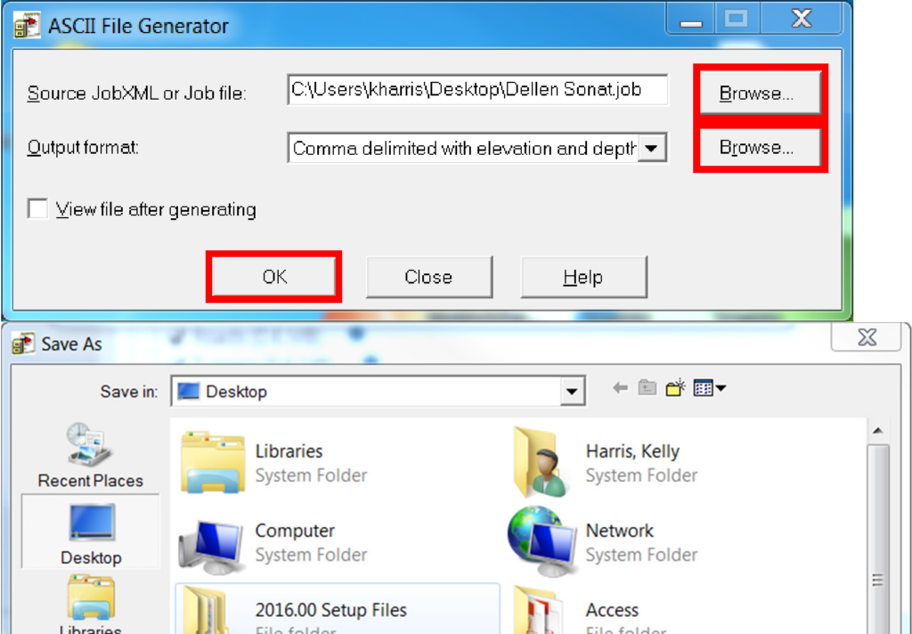
To use ASCII File Generator, once opened, browse to your .job or .jxl file on your computer or USB drive and select the Output Format style you need.
Click OK and Save the file to the desired location.

Note: Depending on the Output Format selected, there may be additional steps to take before the report is generated.

Screenshots of the Trimble ASCII File Generator Utility screen and Save As dialog

Additional style sheets can be downloaded from the Trimble Access Software Downloads webpage.

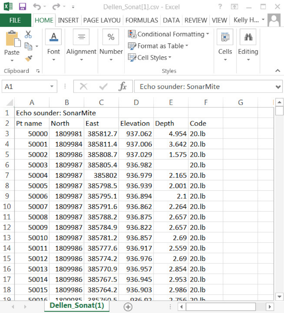
Below is an example of the “comma delimited with elevation and depth” Output Format that you would commonly use with a SonarMite Echosounder.

Screenshot of the Trimble ASCII File Generator Utility "comma delineated with elevation and depth" output format


View the original Survey Technical Support Notes: Trimble ASCII File Generator Utility.pdf

author avatar
Seiler Geospatial
Leading the geospatial industry since 1945, Seiler Geospatial provides top-tier hardware and software solutions. We are Authorized Distributors for Trimble Navigation, Spectra Precision, Esri, Autodesk, DJI, Laser Technology and more. We have nationally recognized service and repair facilities and offer certified training and support across the Midwest.  Our headquarters operates out of St. Louis and we have seven other offices across the Midwest.  Seiler’s team members are all skilled professionals that believe in a hands-on approach to working with our customers.  Our team members include Registered Land Surveyors, Certified GISP Professionals, Licensed Pilots, Certified Trainers as well as other surveying, mapping, LiDAR Specialists and many other skilled professionals and support staff.